
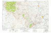
~ Carlsbad NM topo map, 1:250000 scale, 1 X 2 Degree, Historical, 1954, updated 1976
Carlsbad, New Mexico, USGS topographic map dated 1954.
Includes geographic coordinates (latitude and longitude). This topographic map is suitable for hiking, camping, and exploring, or framing it as a wall map.
Printed on-demand using high resolution imagery, on heavy weight and acid free paper, or alternatively on a variety of synthetic materials.
Topos available on paper, Waterproof, Poly, or Tyvek. Usually shipping rolled, unless combined with other folded maps in one order.
- Product Number: USGS-5386438
- Free digital map download (high-resolution, GeoPDF): Carlsbad, New Mexico (file size: 19 MB)
- Map Size: please refer to the dimensions of the GeoPDF map above
- Weight (paper map): ca. 55 grams
- Map Type: POD USGS Topographic Map
- Map Series: HTMC
- Map Verison: Historical
- Cell ID: 68704
- Scan ID: 190039
- Imprint Year: 1976
- Woodland Tint: Yes
- Aerial Photo Year: 1972
- Edit Year: 1972
- Datum: Unstated
- Map Projection: Transverse Mercator
- Map published by United States Geological Survey
- Map Language: English
- Scanner Resolution: 600 dpi
- Map Cell Name: Carlsbad
- Grid size: 1 X 2 Degree
- Date on map: 1954
- Map Scale: 1:250000
- Geographical region: New Mexico, United States
Neighboring Maps:
All neighboring USGS topo maps are available for sale online at a variety of scales.
Spatial coverage:
Topo map Carlsbad, New Mexico, covers the geographical area associated the following places:
- Cole Place - Seven Rivers - Wimsatt - Four Forks - Carlsbad - Dunes - Mountain Park - Atoka - Crisp - Omlee - La Luz - Dunken - Queen - Kearney - Loving - Alamogordo - Corner Well - Elk - Riverside - Three Forks - Illinois Camp - Avalon - La Huerta - Mayhill - Artesia - Hortonville - Knowles Place - Old Wright Place - Black River Village - Hope - Cloudcroft - Harkey Crossing - Malaga - Dog Canyon Estates - Avis - Lookout Crossing - Cienega (historical) - Otis - Old Horner Place - Espuela - Hunter Place - Red Bluff - Chippeway Park - Piñon - Weed - High Rolls - Timberon - Barber Crossing - Old Longbotbam Place - Valmont - Boles Acres - Harroun Crossing - Maxon - San Jose - Marcia - Lookout (historical) - Hagerman Heights - Frontier Post - Dayton - Whites City - Lake Arthur - Four Wells - Sacramento - West Carlsbad
- Map Area ID: AREA3332-106-104
- Northwest corner Lat/Long code: USGSNW33-106
- Northeast corner Lat/Long code: USGSNE33-104
- Southwest corner Lat/Long code: USGSSW32-106
- Southeast corner Lat/Long code: USGSSE32-104
- Northern map edge Latitude: 33
- Southern map edge Latitude: 32
- Western map edge Longitude: -106
- Eastern map edge Longitude: -104


