
~ Albuquerque NM topo map, 1:250000 scale, 1 X 2 Degree, Historical, 1958
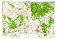
Albuquerque, New Mexico, USGS topographic map dated 1958.
Includes geographic coordinates (latitude and longitude). This topographic map is suitable for hiking, camping, and exploring, or framing it as a wall map.
Printed on-demand using high resolution imagery, on heavy weight and acid free paper, or alternatively on a variety of synthetic materials.
Topos available on paper, Waterproof, Poly, or Tyvek. Usually shipping rolled, unless combined with other folded maps in one order.
- Product Number: USGS-5386404
- Free digital map download (high-resolution, GeoPDF): Albuquerque, New Mexico (file size: 20 MB)
- Map Size: please refer to the dimensions of the GeoPDF map above
- Weight (paper map): ca. 55 grams
- Map Type: POD USGS Topographic Map
- Map Series: HTMC
- Map Verison: Historical
- Cell ID: 68640
- Scan ID: 189538
- Woodland Tint: Yes
- Aerial Photo Year: 1953
- Field Check Year: 1954
- Datum: Unstated
- Map Projection: Transverse Mercator
- Map published by United States Geological Survey
- Map Language: English
- Scanner Resolution: 600 dpi
- Map Cell Name: Albuquerque
- Grid size: 1 X 2 Degree
- Date on map: 1958
- Map Scale: 1:250000
- Geographical region: New Mexico, United States
Neighboring Maps:
All neighboring USGS topo maps are available for sale online at a variety of scales.
Spatial coverage:
Topo map Albuquerque, New Mexico, covers the geographical area associated the following places:
- Edgewood - Rancho Valle - Evergreen Hills Subdivision - San Pedro Overlook - P Simmons Place - Puesta Del Sol - Arenal - Atrisco - North Acomita Village - Ranchito - Martin Place - White Rock - Buena Ventura - Sierra Vista Estates - Leon - San Ysidro - Madrid - Las Colonias - West Village - New Laguna - Torreon - Señorito - Sundance Mesa - Domingo - San Ildefonso Pueblo - Las Huertas - Penistaja - Cuervo Crossing - Fruitvale (historical) - Cubero - Casa Loma - Casa Blanca - Budville - Eagle Nest - San Jose - Rio Rancho Estates - Tecolote - San Pablo - Los Duranes - Carnuel - Milan - Alaska - Corners - Briggs Place - Cabezon - Dennis Chaves Estates - Whitehorse - La Bajada - Acomita - Cañoncito - Porter - Los Cerrilos - Paguate - Las Dos - Santa Clara - Sandia Knolls - Barton - Sandia Vista - San Fidel - Agua Fria - Sandia Pueblo - Harrisburg - North Valley - El Valle de Arroyo Seco - Sedillo - Forest Park - Sierra de los Pinos - Placitas - Sile - Seama - Chical - Otowi - Waldo (historical) - Old Town - San Pedro - El Rancho - Los Candelarias - Philadelphia - Cavasos Place - Riverside - Mesa Village - Cuyamungue - Puertecito - Bland - Cerrillos - Marquez - Los Griegos - Frijoles - Los Pastores - Cochiti - Seven Springs - Peña Blanca - South Valley - Vista de Oro de Placitas - El Dado - Voght Place - Johns Place - Cebolletita - La Madera - Algodones
- Map Area ID: AREA3635-108-106
- Northwest corner Lat/Long code: USGSNW36-108
- Northeast corner Lat/Long code: USGSNE36-106
- Southwest corner Lat/Long code: USGSSW35-108
- Southeast corner Lat/Long code: USGSSE35-106
- Northern map edge Latitude: 36
- Southern map edge Latitude: 35
- Western map edge Longitude: -108
- Eastern map edge Longitude: -106


