
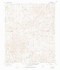
~ Flying H NM topo map, 1:62500 scale, 15 X 15 Minute, Historical, 1961, updated 1975
Flying H, New Mexico, USGS topographic map dated 1961.
Includes geographic coordinates (latitude and longitude). This topographic map is suitable for hiking, camping, and exploring, or framing it as a wall map.
Printed on-demand using high resolution imagery, on heavy weight and acid free paper, or alternatively on a variety of synthetic materials.
Topos available on paper, Waterproof, Poly, or Tyvek. Usually shipping rolled, unless combined with other folded maps in one order.
- Product Number: USGS-5385578
- Free digital map download (high-resolution, GeoPDF): Flying H, New Mexico (file size: 7 MB)
- Map Size: please refer to the dimensions of the GeoPDF map above
- Weight (paper map): ca. 55 grams
- Map Type: POD USGS Topographic Map
- Map Series: HTMC
- Map Verison: Historical
- Cell ID: 54215
- Scan ID: 190639
- Imprint Year: 1975
- Woodland Tint: Yes
- Aerial Photo Year: 1959
- Field Check Year: 1961
- Datum: NAD27
- Map Projection: Polyconic
- Map published by United States Geological Survey
- Map Language: English
- Scanner Resolution: 600 dpi
- Map Cell Name: Flying H
- Grid size: 15 X 15 Minute
- Date on map: 1961
- Map Scale: 1:62500
- Geographical region: New Mexico, United States
Neighboring Maps:
All neighboring USGS topo maps are available for sale online at a variety of scales.
Spatial coverage:
Topo map Flying H, New Mexico, covers the geographical area associated the following places:
- Little Salt House Canyon - Chivo Well - Indian Pasture - Watson Ranch - Lincoln Canyon - Cave Canyon - Cedar Hill Well - Lake Well - Scotty Windmill - Scotty Canyon - Flying H Ranch Airport - Browning Canyon - Loco Canyon - Funk - Shack Tank - Chivo Canyon - Indian Well - Goodrum Ranch - Janey Tank - Rio Felix Volunteer Fire Department - Dry Pasture - Number 2 Well - West Windmill - Luis Well - McKnight Ranch - Teal Canyon - Old Loco Well - Treat Ranch - Skeen Ranch Airport - Slaughter Ranch - Flying H - Gnat Windmill - West Red Pasture - Salt House Canyon - Alto Well - Red House - Pine Tree Well - Number Six Well - R Vandewart Ranch - East Red Pasture - Flying H Post Office (historical) - Morgan Canyon - Burnt Windmill - Number Four Well - Pine Tree Canyon - Sulphur Well - Flying H Ranch Weather Station - Middle Well - High Lonesome Well - Joy Ranch - Twin Butte Well - Little Salt House Well - Shanks Windmill - Salt House - Upper Loco Well - Header Windmill
- Map Area ID: AREA33.2533-105.25-105
- Northwest corner Lat/Long code: USGSNW33.25-105.25
- Northeast corner Lat/Long code: USGSNE33.25-105
- Southwest corner Lat/Long code: USGSSW33-105.25
- Southeast corner Lat/Long code: USGSSE33-105
- Northern map edge Latitude: 33.25
- Southern map edge Latitude: 33
- Western map edge Longitude: -105.25
- Eastern map edge Longitude: -105


