
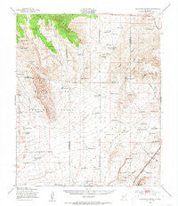
~ Chihuahua Ranch NM topo map, 1:62500 scale, 15 X 15 Minute, Historical, 1948, updated 1954
Chihuahua Ranch, New Mexico, USGS topographic map dated 1948.
Includes geographic coordinates (latitude and longitude). This topographic map is suitable for hiking, camping, and exploring, or framing it as a wall map.
Printed on-demand using high resolution imagery, on heavy weight and acid free paper, or alternatively on a variety of synthetic materials.
Topos available on paper, Waterproof, Poly, or Tyvek. Usually shipping rolled, unless combined with other folded maps in one order.
- Product Number: USGS-5385454
- Free digital map download (high-resolution, GeoPDF): Chihuahua Ranch, New Mexico (file size: 8 MB)
- Map Size: please refer to the dimensions of the GeoPDF map above
- Weight (paper map): ca. 55 grams
- Map Type: POD USGS Topographic Map
- Map Series: HTMC
- Map Verison: Historical
- Cell ID: 52513
- Scan ID: 190151
- Imprint Year: 1954
- Woodland Tint: Yes
- Aerial Photo Year: 1946
- Edit Year: 1948
- Field Check Year: 1947
- Datum: NAD27
- Map Projection: Polyconic
- Map published by United States Army Corps of Engineers
- Map Language: English
- Scanner Resolution: 600 dpi
- Map Cell Name: Chihuahua Ranch
- Grid size: 15 X 15 Minute
- Date on map: 1948
- Map Scale: 1:62500
- Geographical region: New Mexico, United States
Neighboring Maps:
All neighboring USGS topo maps are available for sale online at a variety of scales.
Spatial coverage:
Topo map Chihuahua Ranch, New Mexico, covers the geographical area associated the following places:
- Hill Water Well - R C Withers Tanks - Branum Well - Cattle Guard Well - Butler Tank - Dillard Tank - Rentfro Junior Tank - Pop Jackson Tank - 10001 Water Well - Oscura - Lower Willow Spring - Murray Well - Walker Tank - A A A Tank - Double Tank - Cottonwood Creek - Nolda Tank Number 1 - Rentfro Well - Root Spring - Brown Tank - Harkey Draw - Red Canyon - Sam Dillard Tank - Clark Well - W H Shrum Tank - Red Canyon Spring - Pipe Line Well - Butler Tank - Sixshooter Tank - Willow Springs - Sprole Ranch - M S Crockett Tank - Rim Rock Water Well - J G Tank - Barnes Ranch - Bull Gap Tank - Rentfro Tank Number 2 - Flat Top - White Tank - Panther Tank - Sand Tank - Twin Tanks - Sandy Tank - Withers Ranch - Juan Farmer Tank - Lutz Canyon - Chihuahua Ranch - Craven Tank - Frenchman Tank - The Malpais - Highway Tank - Rim Rock Well - Stevens Tank - A A A Tank - Hill Well - North Water Well - Taylor Canyon - Rim Rock Canyon - Little Red Tank - Newmill Well - Quail Canyon - Sixshooter Canyon - Long Canyon - Bull Gap Canyon - Stark Tank - Dalton Spring - Red Canyon Spring - Wagon Canyon - Red Canyon Range Camp - Craven Well - Oscura Coal Mine - Bull Gap Spring - J S Dillard Tank - Willow Draw - George McDonald Well - School Section Tank - Quail Tank
- Map Area ID: AREA33.7533.5-106.25-106
- Northwest corner Lat/Long code: USGSNW33.75-106.25
- Northeast corner Lat/Long code: USGSNE33.75-106
- Southwest corner Lat/Long code: USGSSW33.5-106.25
- Southeast corner Lat/Long code: USGSSE33.5-106
- Northern map edge Latitude: 33.75
- Southern map edge Latitude: 33.5
- Western map edge Longitude: -106.25
- Eastern map edge Longitude: -106


