
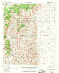
~ Black Top Mountain NM topo map, 1:62500 scale, 15 X 15 Minute, Historical, 1948, updated 1970
Black Top Mountain, New Mexico, USGS topographic map dated 1948.
Includes geographic coordinates (latitude and longitude). This topographic map is suitable for hiking, camping, and exploring, or framing it as a wall map.
Printed on-demand using high resolution imagery, on heavy weight and acid free paper, or alternatively on a variety of synthetic materials.
Topos available on paper, Waterproof, Poly, or Tyvek. Usually shipping rolled, unless combined with other folded maps in one order.
- Product Number: USGS-5385324
- Free digital map download (high-resolution, GeoPDF): Black Top Mountain, New Mexico (file size: 10 MB)
- Map Size: please refer to the dimensions of the GeoPDF map above
- Weight (paper map): ca. 55 grams
- Map Type: POD USGS Topographic Map
- Map Series: HTMC
- Map Verison: Historical
- Cell ID: 51482
- Scan ID: 189803
- Imprint Year: 1970
- Woodland Tint: Yes
- Aerial Photo Year: 1948
- Field Check Year: 1948
- Datum: NAD27
- Map Projection: Polyconic
- Map published by United States Army Corps of Engineers
- Map Language: English
- Scanner Resolution: 600 dpi
- Map Cell Name: Black Top Mountain
- Grid size: 15 X 15 Minute
- Date on map: 1948
- Map Scale: 1:62500
- Geographical region: New Mexico, United States
Neighboring Maps:
All neighboring USGS topo maps are available for sale online at a variety of scales.
Spatial coverage:
Topo map Black Top Mountain, New Mexico, covers the geographical area associated the following places:
- Miller Ranch Headquarters - Hardscrabble Well - Crocket Spring - Dugout Springs - Potter Ranch Headquarters (historical) - Buckhorn Canyon - Bat Ranch Spring - El Paso Canyon - Strawberry Peak - Horse Camp Spring - Richard Tank - Henderson Ranch - Buckhorn Spring - Hackberry Canyon - F E Henderson - Woolf Gap - Tip Top Tank - Walson Well - Independence Mine - Granite Gap - White Rock Canyon - Sulphur Pass - Middle Well - Pilot Knob - Seep Canyon - Eagle Nest Spring - Rhodes Pass - Rhodes Spring - Squaw Tit Canyon - Woolf Spring - Skillet Knob - Bosque Canyon - Dog Seep - Bear Den Tank - Hardin Ranch - Walson Gap - San Andres Mountains - Hardscrabble Canyon - Sulphur Canyon - Lower Hardscrabble Spring - Panther Seep - Cottonwood Canyon - Doe Spring - Waterhole Canyon - Indian Trail Gap - Hackberry Spring (historical) - Valle Vista - Cave Spar - Lower Sulphur Spring - Bear Den Spring - Henderson Well - Tip Top Spring - Granite canyon - Gunsight Peak - Rhodes Canyon - New Well (historical) - Domijohn Canyon - North Richard Tank - Domijohn Well - Bear Den Well - Bosque Spring - Bear Den Canyon - Potter Ranch - White Rock Well - Sulphur Canyon - Bear Den Canyon - Workman Canyon - Nelson Well - Hardscrabble Spring - Cedar Spring - Holcomb Spring - Rock House Spring - Rigon Tanks - Harding Deposit - Jones Seep - Cantrell Well - White Spring - Frank Crockett Ranch Headquarters - Mount Baldy - Big Mountain - Seep Springs - Hardscrabble Mountains - Woolf Ranch Headquarters (historical) - Amole Ridge Canyon - South Well - Rhodes Canyon - Twin Tanks - Black Den Tank - Ash Canyon - Ben Taylor Tank - Black Bear Mine - Red House Well - Esque Spring (historical) - Tip Top Mesa - Panther Canyon - Floyd Crockett Ranch (historical) - Loma Vista - Amole Ridge - Tip Top - Towner Well
- Map Area ID: AREA33.2533-106.75-106.5
- Northwest corner Lat/Long code: USGSNW33.25-106.75
- Northeast corner Lat/Long code: USGSNE33.25-106.5
- Southwest corner Lat/Long code: USGSSW33-106.75
- Southeast corner Lat/Long code: USGSSE33-106.5
- Northern map edge Latitude: 33.25
- Southern map edge Latitude: 33
- Western map edge Longitude: -106.75
- Eastern map edge Longitude: -106.5


