
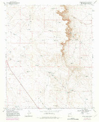
~ Wright Ranch NM topo map, 1:24000 scale, 7.5 X 7.5 Minute, Historical, 1967, updated 1982
Wright Ranch, New Mexico, USGS topographic map dated 1967.
Includes geographic coordinates (latitude and longitude). This topographic map is suitable for hiking, camping, and exploring, or framing it as a wall map.
Printed on-demand using high resolution imagery, on heavy weight and acid free paper, or alternatively on a variety of synthetic materials.
Topos available on paper, Waterproof, Poly, or Tyvek. Usually shipping rolled, unless combined with other folded maps in one order.
- Product Number: USGS-5385179
- Free digital map download (high-resolution, GeoPDF): Wright Ranch, New Mexico (file size: 9 MB)
- Map Size: please refer to the dimensions of the GeoPDF map above
- Weight (paper map): ca. 55 grams
- Map Type: POD USGS Topographic Map
- Map Series: HTMC
- Map Verison: Historical
- Cell ID: 49922
- Scan ID: 193631
- Imprint Year: 1982
- Photo Revision Year: 1982
- Aerial Photo Year: 1979
- Edit Year: 1982
- Datum: NAD27
- Map Projection: Polyconic
- Map published by United States Geological Survey
- Map Language: English
- Scanner Resolution: 600 dpi
- Map Cell Name: Wright Ranch
- Grid size: 7.5 X 7.5 Minute
- Date on map: 1967
- Map Scale: 1:24000
- Geographical region: New Mexico, United States
Neighboring Maps:
All neighboring USGS topo maps are available for sale online at a variety of scales.
Spatial coverage:
Topo map Wright Ranch, New Mexico, covers the geographical area associated the following places:
- Dipping Vat Lake - Hub Corn Tank - Dunlap Camp Tank - Robertson Fence Tank - Electric Wells - Cocklebur Tank - Turner Draw - North Sandhills Tank - Lower Turner Tank - Panama Martin Tank - Miller Wells - Antelope Tank - Coyote Tank - Six Windmills - Burro Junior Tank - Burro Tank - White Rock Tank - Mail Carrier Lake - Loco Draw - Wright Ranch - Loco Tank - Turner Tank - High Lonesome Windmill - Little Tank - Mexican Lake Wells - Posie Tank - Highway Tank - Rock Lake Tank - South Sandhills Tank - Red Lake - Charlies Tank - Berts Well - Ryan Tank
- Map Area ID: AREA34.2534.125-104.875-104.75
- Northwest corner Lat/Long code: USGSNW34.25-104.875
- Northeast corner Lat/Long code: USGSNE34.25-104.75
- Southwest corner Lat/Long code: USGSSW34.125-104.875
- Southeast corner Lat/Long code: USGSSE34.125-104.75
- Northern map edge Latitude: 34.25
- Southern map edge Latitude: 34.125
- Western map edge Longitude: -104.875
- Eastern map edge Longitude: -104.75


