
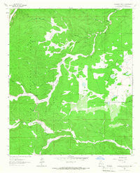
~ Woodson Canyon NM topo map, 1:24000 scale, 7.5 X 7.5 Minute, Historical, 1963, updated 1967
Woodson Canyon, New Mexico, USGS topographic map dated 1963.
Includes geographic coordinates (latitude and longitude). This topographic map is suitable for hiking, camping, and exploring, or framing it as a wall map.
Printed on-demand using high resolution imagery, on heavy weight and acid free paper, or alternatively on a variety of synthetic materials.
Topos available on paper, Waterproof, Poly, or Tyvek. Usually shipping rolled, unless combined with other folded maps in one order.
- Product Number: USGS-5385173
- Free digital map download (high-resolution, GeoPDF): Woodson Canyon, New Mexico (file size: 11 MB)
- Map Size: please refer to the dimensions of the GeoPDF map above
- Weight (paper map): ca. 55 grams
- Map Type: POD USGS Topographic Map
- Map Series: HTMC
- Map Verison: Historical
- Cell ID: 49819
- Scan ID: 193629
- Imprint Year: 1967
- Woodland Tint: Yes
- Aerial Photo Year: 1963
- Field Check Year: 1963
- Datum: NAD27
- Map Projection: Polyconic
- Map published by United States Geological Survey
- Map Language: English
- Scanner Resolution: 600 dpi
- Map Cell Name: Woodson Canyon
- Grid size: 7.5 X 7.5 Minute
- Date on map: 1963
- Map Scale: 1:24000
- Geographical region: New Mexico, United States
Neighboring Maps:
All neighboring USGS topo maps are available for sale online at a variety of scales.
Spatial coverage:
Topo map Woodson Canyon, New Mexico, covers the geographical area associated the following places:
- Hunter Canyon - Section 24 Tank - Rock Tank Canyon - Prather Tank - Railsplitter Tank Number Two - Allen Lake - Dela Van Lake - Reilsplitter Tank Number Three - Section Eleven Tank - Schoolhouse Tank - Barkley Lake - Snow Canyon - Middle Tank - Miller Flats - McEwan Canyon - Stephens Well - Cantwell Lake - Bud Holland Canyon - Little Tank - Lewis Ranch - Bluewater Canyon - Rock Draw Tank - Graveyard Canyon - Ernest Well - Lusk Cemetery - Hackberry Lake - Lower Snow Tank - Perk Canyon - CCC Tank - Stephens Tanks - Flume Canyon - Bible Canyon - Covel Lake - Graveyard Tank - Key Tank - Miller Well - Prather Canyon - McDonald Lake - Wilson Lake - Bell Tank - McDonald Flat - Woodson Canyon - Dougherty Well - Snow Tank - Little Tank
- Map Area ID: AREA32.87532.75-105.5-105.375
- Northwest corner Lat/Long code: USGSNW32.875-105.5
- Northeast corner Lat/Long code: USGSNE32.875-105.375
- Southwest corner Lat/Long code: USGSSW32.75-105.5
- Southeast corner Lat/Long code: USGSSE32.75-105.375
- Northern map edge Latitude: 32.875
- Southern map edge Latitude: 32.75
- Western map edge Longitude: -105.5
- Eastern map edge Longitude: -105.375


