
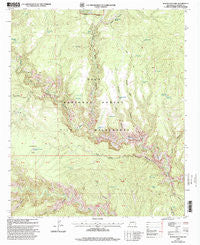
~ Woodland Park NM topo map, 1:24000 scale, 7.5 X 7.5 Minute, Historical, 1999, updated 2002
Woodland Park, New Mexico, USGS topographic map dated 1999.
Includes geographic coordinates (latitude and longitude). This topographic map is suitable for hiking, camping, and exploring, or framing it as a wall map.
Printed on-demand using high resolution imagery, on heavy weight and acid free paper, or alternatively on a variety of synthetic materials.
Topos available on paper, Waterproof, Poly, or Tyvek. Usually shipping rolled, unless combined with other folded maps in one order.
- Product Number: USGS-5385167
- Free digital map download (high-resolution, GeoPDF): Woodland Park, New Mexico (file size: 14 MB)
- Map Size: please refer to the dimensions of the GeoPDF map above
- Weight (paper map): ca. 55 grams
- Map Type: POD USGS Topographic Map
- Map Series: HTMC
- Map Verison: Historical
- Cell ID: 49773
- Scan ID: 194764
- Imprint Year: 2002
- Woodland Tint: Yes
- Aerial Photo Year: 1996
- Edit Year: 2000
- Datum: NAD27
- Map Projection: Transverse Mercator
- Map published by United States Forest Service
- Map Language: English
- Scanner Resolution: 600 dpi
- Map Cell Name: Woodland Park
- Grid size: 7.5 X 7.5 Minute
- Date on map: 1999
- Map Scale: 1:24000
- Geographical region: New Mexico, United States
Neighboring Maps:
All neighboring USGS topo maps are available for sale online at a variety of scales.
Spatial coverage:
Topo map Woodland Park, New Mexico, covers the geographical area associated the following places:
- East Water Canyon - Prior Cabin - Indian Creek Canyon - Green Fly Trail - Little Bear Canyon - Gila National Forest - Brothers West Tank - Dirt Tank Number 2 - Basin Tank - Deep Tank - Woodland Park Tank - Brothers West Canyon - Pino Tank - Big Bear Tank - Jordan Mesa Tank - Yellow Bear Tank - Nat Straw Canyon - Little Bear Tank - Adobe Tank - Coffee Pot Tank - Jordan Canyon - Middle Fork Tank - Dirt Tank - Ring Canyon - Prior Creek - Wild Tank - Indian Creek - Woodland Park Trail - Grave Tank - Ramon Tank - Arrowhead Tank - The Meadows - Rock Tank - Grave Canyon - Marceleno Tank - Big Bear Canyon - Green Fly Tanks - Woodland Park - Green Fly Tank Number One - Cassidy Spring - House Log Canyon - Yellow Mountain - Sam Martin Spring - Green Fly Tank Number 2 - Chicken Coop Canyon
- Map Area ID: AREA33.37533.25-108.375-108.25
- Northwest corner Lat/Long code: USGSNW33.375-108.375
- Northeast corner Lat/Long code: USGSNE33.375-108.25
- Southwest corner Lat/Long code: USGSSW33.25-108.375
- Southeast corner Lat/Long code: USGSSE33.25-108.25
- Northern map edge Latitude: 33.375
- Southern map edge Latitude: 33.25
- Western map edge Longitude: -108.375
- Eastern map edge Longitude: -108.25


