
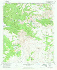
~ Wilson Mountain NM topo map, 1:24000 scale, 7.5 X 7.5 Minute, Historical, 1965, updated 1969
Wilson Mountain, New Mexico, USGS topographic map dated 1965.
Includes geographic coordinates (latitude and longitude). This topographic map is suitable for hiking, camping, and exploring, or framing it as a wall map.
Printed on-demand using high resolution imagery, on heavy weight and acid free paper, or alternatively on a variety of synthetic materials.
Topos available on paper, Waterproof, Poly, or Tyvek. Usually shipping rolled, unless combined with other folded maps in one order.
- Product Number: USGS-5385113
- Free digital map download (high-resolution, GeoPDF): Wilson Mountain, New Mexico (file size: 12 MB)
- Map Size: please refer to the dimensions of the GeoPDF map above
- Weight (paper map): ca. 55 grams
- Map Type: POD USGS Topographic Map
- Map Series: HTMC
- Map Verison: Historical
- Cell ID: 49338
- Scan ID: 193606
- Imprint Year: 1969
- Woodland Tint: Yes
- Aerial Photo Year: 1964
- Field Check Year: 1965
- Datum: NAD27
- Map Projection: Polyconic
- Map published by United States Geological Survey
- Map Language: English
- Scanner Resolution: 600 dpi
- Map Cell Name: Wilson Mountain
- Grid size: 7.5 X 7.5 Minute
- Date on map: 1965
- Map Scale: 1:24000
- Geographical region: New Mexico, United States
Neighboring Maps:
All neighboring USGS topo maps are available for sale online at a variety of scales.
Spatial coverage:
Topo map Wilson Mountain, New Mexico, covers the geographical area associated the following places:
- Frisco Hot Springs - Pasture Tank - Upper Drift Fence Tank - Table Top - Saddle Tank - Upper Sipes Spring - Lollipop Tank - Single Tree Tank - Box Tank - Branding Tree Spring - Fence Tank - West Ant Tank - Drift Fence Tank - Cave Canyon - Lightning Mesa Tank - Snow Peak - Angel Roost - San Francisco Hot Springs - Antelope Flat - Sunflower Tank - The Box - Wilson Mountain - West Masonry Tank - Back of Pasture Tank - Lower Pasture Tank - Cottonwood Tank - Cat Spring - Cottonwood Canyon - Sundial Mountain - Park Tank Number Two - Henry Ranch - Zumwalt Ranch - Goat Basin Canyon - Big Pasture Tank - Sipes Canyon - Tennessee Creek - Ditch Tank - Park Tank - Blacktail Tanks - Water Development Tank - Squirrel Canyon - Lower Ant Spring - Rock Tank - Table Top Spring - Turkey Basin Tank - Pine Cienega Creek - Lost Grave Canyon - Ringtail Canyon - Rough Tank - Buckhorn Tank - Pothole Canyon - Lightning Mesa - Hanna Mountain - Potholes Country - Mule Creek - Gorilla Spring - Jeep Tank - Brandy Tree Tank - East Tank - Big Dry Creek - Juniper Flat - Juniper Flat Tanks - Ant Spring - Section Three Tank - Sipes Spring - Ant Spring Canyon - Cat Claw Tank - Sawmill Creek - Cottonwood Canyon - Lower San Francisco Wilderness Study Area - Outlaw Mountain
- Map Area ID: AREA33.2533.125-109-108.875
- Northwest corner Lat/Long code: USGSNW33.25-109
- Northeast corner Lat/Long code: USGSNE33.25-108.875
- Southwest corner Lat/Long code: USGSSW33.125-109
- Southeast corner Lat/Long code: USGSSE33.125-108.875
- Northern map edge Latitude: 33.25
- Southern map edge Latitude: 33.125
- Western map edge Longitude: -109
- Eastern map edge Longitude: -108.875


