
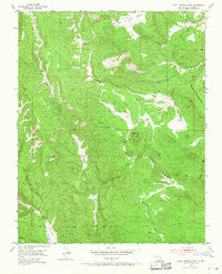
~ Valle Grande Peak NM topo map, 1:24000 scale, 7.5 X 7.5 Minute, Historical, 1953, updated 1968
Valle Grande Peak, New Mexico, USGS topographic map dated 1953.
Includes geographic coordinates (latitude and longitude). This topographic map is suitable for hiking, camping, and exploring, or framing it as a wall map.
Printed on-demand using high resolution imagery, on heavy weight and acid free paper, or alternatively on a variety of synthetic materials.
Topos available on paper, Waterproof, Poly, or Tyvek. Usually shipping rolled, unless combined with other folded maps in one order.
- Product Number: USGS-5384767
- Free digital map download (high-resolution, GeoPDF): Valle Grande Peak, New Mexico (file size: 14 MB)
- Map Size: please refer to the dimensions of the GeoPDF map above
- Weight (paper map): ca. 55 grams
- Map Type: POD USGS Topographic Map
- Map Series: HTMC
- Map Verison: Historical
- Cell ID: 46546
- Scan ID: 193468
- Imprint Year: 1968
- Woodland Tint: Yes
- Aerial Photo Year: 1947
- Field Check Year: 1953
- Datum: NAD27
- Map Projection: Polyconic
- Map published by United States Geological Survey
- Map Language: English
- Scanner Resolution: 600 dpi
- Map Cell Name: Valle Grande Peak
- Grid size: 7.5 X 7.5 Minute
- Date on map: 1953
- Map Scale: 1:24000
- Geographical region: New Mexico, United States
Neighboring Maps:
All neighboring USGS topo maps are available for sale online at a variety of scales.
Spatial coverage:
Topo map Valle Grande Peak, New Mexico, covers the geographical area associated the following places:
- Borracho Forest Service Facility - Petrero Waterfall - La Cueva Springs - Osa Spring - Jacal De Palo Spring - Los Gatos Tank - Sotano Saddle - Calavera Spring - Truck Trail Tank - Cañon de la Cueva - South Fork Cañada del Agua - Valle Grande Truck Trail - El Rito Ranger District - Ortega Tank - North Fork Cañada del Agua - Middle Fork Cañada del Agua - Cañada del Potrero - Cañada Piedra Amarilla - Posos Spring - La Jarita Ranches - Sotano Tank - Jarita Tank - La Madera Mountain - Valle Grande Peak - Chupa Rosas Tank - Bull Tank - Canon Largo Tank - Arroyo Seco Spring - Cañada del Rancho - Cañada del Puertecito - Jarita Tank Number Two - Cañada de la Jarita - Rincon de Tio Francisquito - Martinez Tank
- Map Area ID: AREA36.536.375-106.25-106.125
- Northwest corner Lat/Long code: USGSNW36.5-106.25
- Northeast corner Lat/Long code: USGSNE36.5-106.125
- Southwest corner Lat/Long code: USGSSW36.375-106.25
- Southeast corner Lat/Long code: USGSSE36.375-106.125
- Northern map edge Latitude: 36.5
- Southern map edge Latitude: 36.375
- Western map edge Longitude: -106.25
- Eastern map edge Longitude: -106.125


