
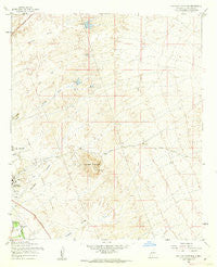
~ Tortugas Mountain NM topo map, 1:24000 scale, 7.5 X 7.5 Minute, Historical, 1955, updated 1962
Tortugas Mountain, New Mexico, USGS topographic map dated 1955.
Includes geographic coordinates (latitude and longitude). This topographic map is suitable for hiking, camping, and exploring, or framing it as a wall map.
Printed on-demand using high resolution imagery, on heavy weight and acid free paper, or alternatively on a variety of synthetic materials.
Topos available on paper, Waterproof, Poly, or Tyvek. Usually shipping rolled, unless combined with other folded maps in one order.
- Product Number: USGS-5384544
- Free digital map download (high-resolution, GeoPDF): Tortugas Mountain, New Mexico (file size: 10 MB)
- Map Size: please refer to the dimensions of the GeoPDF map above
- Weight (paper map): ca. 55 grams
- Map Type: POD USGS Topographic Map
- Map Series: HTMC
- Map Verison: Historical
- Cell ID: 45462
- Scan ID: 193347
- Imprint Year: 1962
- Woodland Tint: Yes
- Aerial Photo Year: 1954
- Field Check Year: 1955
- Datum: NAD27
- Map Projection: Polyconic
- Map published by United States Geological Survey
- Map Language: English
- Scanner Resolution: 600 dpi
- Map Cell Name: Tortugas Mountain
- Grid size: 7.5 X 7.5 Minute
- Date on map: 1955
- Map Scale: 1:24000
- Geographical region: New Mexico, United States
Neighboring Maps:
All neighboring USGS topo maps are available for sale online at a variety of scales.
Spatial coverage:
Topo map Tortugas Mountain, New Mexico, covers the geographical area associated the following places:
- Hoffer MN Prospect - South Fork Dam - Manganese Number Two Mine - Cox Pit Number Two - Little Dam - Burn Pit - Memorial Medical Center - Manganese Number One Mine - Jesse Well - SK Standard Mine - City 24 Water Well - Well 17 Water Well - Fillmore (historical) - Tortugas Watershed Site Number Two Dam - Las Alturas Volunteer Fire Department Talavera Substation - Las Alturas Estates Wells - Tortugas Mine - Las Cruces Division - Memorial General Hospital Helistop - Alameda Dam - Santiago - New Mexico State Police District 4 Las Cruces - University Park Census Designated Place - Triangle Placer Minning Claim - A Mountain-Inman Pit - NMSU 3 Water Well - Tortugas Cemetery - Triangle Placer Mine - Advanced Care Hospital of Southern New Mexico - Tortugas Site Number One Dam - South Fork Las Cruces Arroyo - Jones - Las Alturas Fire Department - City Water Well 9 - Las Cruces Fire Department Station 4 - NMSU 4 Water Well - New Mexico State University Fire and Emergency Services - 10096 Water Well - MountainView Regional Medical Center - North Fork Dam - Mesilla Valley Mall - Tortugas Arroyo - NMSU 9 Water Well - Fillmore Site Number One Dam - Rehabilitation Hospital of Southern New Mexico - North Fork Las Cruces Arroyo - Tortugas Mountain
- Map Area ID: AREA32.37532.25-106.75-106.625
- Northwest corner Lat/Long code: USGSNW32.375-106.75
- Northeast corner Lat/Long code: USGSNE32.375-106.625
- Southwest corner Lat/Long code: USGSSW32.25-106.75
- Southeast corner Lat/Long code: USGSSE32.25-106.625
- Northern map edge Latitude: 32.375
- Southern map edge Latitude: 32.25
- Western map edge Longitude: -106.75
- Eastern map edge Longitude: -106.625


