
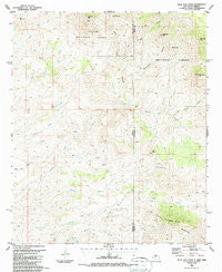
~ Tillie Hall Peak NM topo map, 1:24000 scale, 7.5 X 7.5 Minute, Historical, 1986, updated 1987
Tillie Hall Peak, New Mexico, USGS topographic map dated 1986.
Includes geographic coordinates (latitude and longitude). This topographic map is suitable for hiking, camping, and exploring, or framing it as a wall map.
Printed on-demand using high resolution imagery, on heavy weight and acid free paper, or alternatively on a variety of synthetic materials.
Topos available on paper, Waterproof, Poly, or Tyvek. Usually shipping rolled, unless combined with other folded maps in one order.
- Product Number: USGS-5384454
- Free digital map download (high-resolution, GeoPDF): Tillie Hall Peak, New Mexico (file size: 12 MB)
- Map Size: please refer to the dimensions of the GeoPDF map above
- Weight (paper map): ca. 55 grams
- Map Type: POD USGS Topographic Map
- Map Series: HTMC
- Map Verison: Historical
- Cell ID: 71841
- Scan ID: 194581
- Imprint Year: 1987
- Woodland Tint: Yes
- Aerial Photo Year: 1981
- Edit Year: 1986
- Field Check Year: 1983
- Datum: NAD27
- Map Projection: Transverse Mercator
- Map published by United States Geological Survey
- Map Language: English
- Scanner Resolution: 600 dpi
- Map Cell Name: Tillie Hall Peak
- Grid size: 7.5 X 7.5 Minute
- Date on map: 1986
- Map Scale: 1:24000
- Geographical region: New Mexico, United States
Neighboring Maps:
All neighboring USGS topo maps are available for sale online at a variety of scales.
Spatial coverage:
Topo map Tillie Hall Peak, New Mexico, covers the geographical area associated the following places:
- Skully Creek Ranch - Forest Boundary Corral - Hells Hole Spring - Hells Hole Spring - Upper Linden Spring - Tom Osher Springs - Lower Winchester Spring - Hells Hole Spring - Yellowjacket Peak - Bitter Creek Spring - Winchester Canyon - Tillie Hall Peak - Corner Tank - Forest Boundary Corral - Winchester Peak - Grapevine Spring - Grapevine Spring - Smith Ranch - Twin Peaks Mine - Saddleback Mountain - Leta Lynn Prospect - Branding Iron Spring - Mule Mountain - Miner Spring - Tillie Hall Canyon - Coyote Spring - Franks Tank - Johnson Ranch - Middle Linden Spring - Corner Spring - Miner Spring - Stateline Corral - Twin Peaks - Stateline Corral - Coyote Corral - Four L Bar Ranch - Black Willow Spring - Hells Hole Peak - Iron Canyon - Twin Peaks - Hells Hole - Hells Hole Canyon - Willow Creek - Tom O'Shea Springs - Water Haul Spring - Branding Iron Spring - Dark Thunder Canyon - Willis Ranch - Lower Winchester Spring
- Map Area ID: AREA3332.875-109.125-109
- Northwest corner Lat/Long code: USGSNW33-109.125
- Northeast corner Lat/Long code: USGSNE33-109
- Southwest corner Lat/Long code: USGSSW32.875-109.125
- Southeast corner Lat/Long code: USGSSE32.875-109
- Northern map edge Latitude: 33
- Southern map edge Latitude: 32.875
- Western map edge Longitude: -109.125
- Eastern map edge Longitude: -109


