
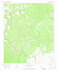
~ Telephone Canyon NM topo map, 1:24000 scale, 7.5 X 7.5 Minute, Historical, 1963, updated 1974
Telephone Canyon, New Mexico, USGS topographic map dated 1963.
Includes geographic coordinates (latitude and longitude). This topographic map is suitable for hiking, camping, and exploring, or framing it as a wall map.
Printed on-demand using high resolution imagery, on heavy weight and acid free paper, or alternatively on a variety of synthetic materials.
Topos available on paper, Waterproof, Poly, or Tyvek. Usually shipping rolled, unless combined with other folded maps in one order.
- Product Number: USGS-5384308
- Free digital map download (high-resolution, GeoPDF): Telephone Canyon, New Mexico (file size: 10 MB)
- Map Size: please refer to the dimensions of the GeoPDF map above
- Weight (paper map): ca. 55 grams
- Map Type: POD USGS Topographic Map
- Map Series: HTMC
- Map Verison: Historical
- Cell ID: 44486
- Scan ID: 193240
- Imprint Year: 1974
- Woodland Tint: Yes
- Aerial Photo Year: 1958
- Field Check Year: 1963
- Datum: NAD27
- Map Projection: Polyconic
- Map published by United States Geological Survey
- Map Language: English
- Scanner Resolution: 600 dpi
- Map Cell Name: Telephone Canyon
- Grid size: 7.5 X 7.5 Minute
- Date on map: 1963
- Map Scale: 1:24000
- Geographical region: New Mexico, United States
Neighboring Maps:
All neighboring USGS topo maps are available for sale online at a variety of scales.
Spatial coverage:
Topo map Telephone Canyon, New Mexico, covers the geographical area associated the following places:
- Elk Mountain - Logger Spring - Eckleberger Hill - Dark Canyon - Water Canyon Tank - Hail Canyon - Ridge Tank - Gwynn Camp - Sheppard Tank - Turkey Park - Rainy Mesa Camp - Gwynn Tank - Salthouse Canyon - Rocker Canyon - Elk Horn Canyon - Telephone Tank - Gwynn Cienega - Rock Tanks - Rainy Mesa Tank - Water Canyon - Feathery Hill - Sheepherders Baseball Park - Gwynn Canyon - Pasture Canyon - Perry Canyon - Telephone Canyon - Eckleberger Spring - Negrito Airstrip - Top Tank - Gilson Ranch - Elk Mountain Divide - Beaverdam Canyon - West Salt House Tank - Yequas Park - Eckleberger Canyon - Brennand Ranch - Rock Tank Number Two - Negrito Work Center - Elkhorn Spring - Sheppard Canyon
- Map Area ID: AREA33.62533.5-108.625-108.5
- Northwest corner Lat/Long code: USGSNW33.625-108.625
- Northeast corner Lat/Long code: USGSNE33.625-108.5
- Southwest corner Lat/Long code: USGSSW33.5-108.625
- Southeast corner Lat/Long code: USGSSE33.5-108.5
- Northern map edge Latitude: 33.625
- Southern map edge Latitude: 33.5
- Western map edge Longitude: -108.625
- Eastern map edge Longitude: -108.5


