
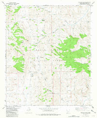
~ Sulphur Pass NM topo map, 1:24000 scale, 7.5 X 7.5 Minute, Historical, 1981, updated 1981
Sulphur Pass, New Mexico, USGS topographic map dated 1981.
Includes geographic coordinates (latitude and longitude). This topographic map is suitable for hiking, camping, and exploring, or framing it as a wall map.
Printed on-demand using high resolution imagery, on heavy weight and acid free paper, or alternatively on a variety of synthetic materials.
Topos available on paper, Waterproof, Poly, or Tyvek. Usually shipping rolled, unless combined with other folded maps in one order.
- Product Number: USGS-5384164
- Free digital map download (high-resolution, GeoPDF): Sulphur Pass, New Mexico (file size: 11 MB)
- Map Size: please refer to the dimensions of the GeoPDF map above
- Weight (paper map): ca. 55 grams
- Map Type: POD USGS Topographic Map
- Map Series: HTMC
- Map Verison: Historical
- Cell ID: 43695
- Scan ID: 193178
- Imprint Year: 1981
- Woodland Tint: Yes
- Aerial Photo Year: 1972
- Edit Year: 1981
- Field Check Year: 1975
- Datum: NAD27
- Map Projection: Transverse Mercator
- Map published by United States Geological Survey
- Map Language: English
- Scanner Resolution: 600 dpi
- Map Cell Name: Sulphur Pass
- Grid size: 7.5 X 7.5 Minute
- Date on map: 1981
- Map Scale: 1:24000
- Geographical region: New Mexico, United States
Neighboring Maps:
All neighboring USGS topo maps are available for sale online at a variety of scales.
Spatial coverage:
Topo map Sulphur Pass, New Mexico, covers the geographical area associated the following places:
- Crocket Spring - New Well (historical) - Sulphur Spring - Woolf Spring - North Richard Tank - Woolf Ranch Headquarters (historical) - Rock House Well - Frank Crockett Ranch Headquarters - White Spring - Hackberry Canyon - Lower Sulphur Spring - Ben Taylor Tank - Cottonwood Spring - Loma Vista - Richard Tank - Horse Camp Spring - Buckhorn Canyon - Murray Well - Quemado Spring - Squaw Tit Canyon - Hackberry Spring (historical) - Doe Spring - Buckhorn Spring - Domijohn Canyon - Taylor Tank - Dog Seep - Cedar Spring - Pilot Knob - Esque Spring (historical) - Sulphur Pass - Walson Gap - Big Mountain - Holcomb Spring - Sulphur Flats - Floyd Crockett Ranch (historical) - Walson Well - El Paso Canyon - Woolf Gap - San Andres Mountains - Domijohn Well - Upper Cottonwood Spring - Tub Spring
- Map Area ID: AREA33.12533-106.75-106.625
- Northwest corner Lat/Long code: USGSNW33.125-106.75
- Northeast corner Lat/Long code: USGSNE33.125-106.625
- Southwest corner Lat/Long code: USGSSW33-106.75
- Southeast corner Lat/Long code: USGSSE33-106.625
- Northern map edge Latitude: 33.125
- Southern map edge Latitude: 33
- Western map edge Longitude: -106.75
- Eastern map edge Longitude: -106.625


