
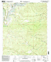
~ Squirrel Springs Canyon NM topo map, 1:24000 scale, 7.5 X 7.5 Minute, Historical, 1999, updated 2002
Squirrel Springs Canyon, New Mexico, USGS topographic map dated 1999.
Includes geographic coordinates (latitude and longitude). This topographic map is suitable for hiking, camping, and exploring, or framing it as a wall map.
Printed on-demand using high resolution imagery, on heavy weight and acid free paper, or alternatively on a variety of synthetic materials.
Topos available on paper, Waterproof, Poly, or Tyvek. Usually shipping rolled, unless combined with other folded maps in one order.
- Product Number: USGS-5384114
- Free digital map download (high-resolution, GeoPDF): Squirrel Springs Canyon, New Mexico (file size: 12 MB)
- Map Size: please refer to the dimensions of the GeoPDF map above
- Weight (paper map): ca. 55 grams
- Map Type: POD USGS Topographic Map
- Map Series: HTMC
- Map Verison: Historical
- Cell ID: 42801
- Scan ID: 194501
- Imprint Year: 2002
- Woodland Tint: Yes
- Aerial Photo Year: 1996
- Edit Year: 2000
- Datum: NAD27
- Map Projection: Transverse Mercator
- Map published by United States Forest Service
- Map Language: English
- Scanner Resolution: 600 dpi
- Map Cell Name: Squirrel Springs Canyon
- Grid size: 7.5 X 7.5 Minute
- Date on map: 1999
- Map Scale: 1:24000
- Geographical region: New Mexico, United States
Neighboring Maps:
All neighboring USGS topo maps are available for sale online at a variety of scales.
Spatial coverage:
Topo map Squirrel Springs Canyon, New Mexico, covers the geographical area associated the following places:
- Lower Cold Spring - South Sand Canyon - Third Apache Canyon - Upper Cold Spring - First Apache Canyon - Apache Creek Census Designated Place - Second Apache Canyon - North Squirrel Springs Canyon - Five Springs Canyon - Govina Canyon Tank Number 1 - Huey Tank - Middle Canyon Tank Number 2 - Govina Canyon Tank Number 8 - Top Tank - Bear Tank - South Squirrel Springs Canyon - Posthole Tank - Caguila Canyon - Squirrel Spring - Caquila Corral - Mesa Tank - Foster Spring - Middle Canyon Tank Number 1 - Middle Tank - Lower Squirrel Spring - Govina Canyon - South Sand Tank - North Sand Canyon - Sand Canyon - Sand Canyon Tank
- Map Area ID: AREA33.87533.75-108.625-108.5
- Northwest corner Lat/Long code: USGSNW33.875-108.625
- Northeast corner Lat/Long code: USGSNE33.875-108.5
- Southwest corner Lat/Long code: USGSSW33.75-108.625
- Southeast corner Lat/Long code: USGSSE33.75-108.5
- Northern map edge Latitude: 33.875
- Southern map edge Latitude: 33.75
- Western map edge Longitude: -108.625
- Eastern map edge Longitude: -108.5


