
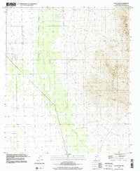
~ South Peak NM topo map, 1:24000 scale, 7.5 X 7.5 Minute, Historical, 1996, updated 2002
South Peak, New Mexico, USGS topographic map dated 1996.
Includes geographic coordinates (latitude and longitude). This topographic map is suitable for hiking, camping, and exploring, or framing it as a wall map.
Printed on-demand using high resolution imagery, on heavy weight and acid free paper, or alternatively on a variety of synthetic materials.
Topos available on paper, Waterproof, Poly, or Tyvek. Usually shipping rolled, unless combined with other folded maps in one order.
- Product Number: USGS-5384074
- Free digital map download (high-resolution, GeoPDF): South Peak, New Mexico (file size: 10 MB)
- Map Size: please refer to the dimensions of the GeoPDF map above
- Weight (paper map): ca. 55 grams
- Map Type: POD USGS Topographic Map
- Map Series: HTMC
- Map Verison: Historical
- Cell ID: 42267
- Scan ID: 194494
- Imprint Year: 2002
- Woodland Tint: Yes
- Photo Inspection Year: 1996
- Aerial Photo Year: 1962
- Edit Year: 2002
- Datum: NAD27
- Map Projection: Universal Transverse Mercator
- Map published by United States Geological Survey
- Map Language: English
- Scanner Resolution: 600 dpi
- Map Cell Name: South Peak
- Grid size: 7.5 X 7.5 Minute
- Date on map: 1996
- Map Scale: 1:24000
- Geographical region: New Mexico, United States
Neighboring Maps:
All neighboring USGS topo maps are available for sale online at a variety of scales.
Spatial coverage:
Topo map South Peak, New Mexico, covers the geographical area associated the following places:
- 10352 Water Well - 00811 Water Well - 10349 Water Well - 00804 Water Well - 00660 Water Well - Shaw Prospect - 00721 Water Well - Park - 10306 Water Well - 00813 Water Well - 00814 Water Well - Crawford Ranch - 01436 Water Well - 00829 Water Well - White Hills - 10338 Water Well - 10327 Water Well - 00806 Water Well - 00718 Water Well - South Peak - 00722 Water Well - 00812 Water Well - 00659 Water Well - 00726 Water Well - Palayo Tank - 10329 Water Well - 00720 Water Well - 10350 Water Well - Big Pocket-Florida Mountains Area - 00807 Water Well - 00837 Water Well - 00832 Water Well - 06146 Water Well - 00725 Water Well - 10326 Water Well - 06011 Water Well - 00828 Water Well - 10328 Water Well - 00808 Water Well - McBee Windmill - 00719 Water Well - 10339 Water Well - South Side - Mahoney Park
- Map Area ID: AREA32.12532-107.75-107.625
- Northwest corner Lat/Long code: USGSNW32.125-107.75
- Northeast corner Lat/Long code: USGSNE32.125-107.625
- Southwest corner Lat/Long code: USGSSW32-107.75
- Southeast corner Lat/Long code: USGSSE32-107.625
- Northern map edge Latitude: 32.125
- Southern map edge Latitude: 32
- Western map edge Longitude: -107.75
- Eastern map edge Longitude: -107.625


