
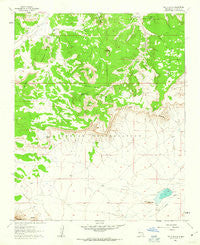
~ South Butte NM topo map, 1:24000 scale, 7.5 X 7.5 Minute, Historical, 1960, updated 1963
South Butte, New Mexico, USGS topographic map dated 1960.
Includes geographic coordinates (latitude and longitude). This topographic map is suitable for hiking, camping, and exploring, or framing it as a wall map.
Printed on-demand using high resolution imagery, on heavy weight and acid free paper, or alternatively on a variety of synthetic materials.
Topos available on paper, Waterproof, Poly, or Tyvek. Usually shipping rolled, unless combined with other folded maps in one order.
- Product Number: USGS-5384058
- Free digital map download (high-resolution, GeoPDF): South Butte, New Mexico (file size: 9 MB)
- Map Size: please refer to the dimensions of the GeoPDF map above
- Weight (paper map): ca. 55 grams
- Map Type: POD USGS Topographic Map
- Map Series: HTMC
- Map Verison: Historical
- Cell ID: 42158
- Scan ID: 193118
- Imprint Year: 1963
- Woodland Tint: Yes
- Aerial Photo Year: 1951
- Field Check Year: 1960
- Datum: NAD27
- Map Projection: Polyconic
- Map published by United States Geological Survey
- Map Language: English
- Scanner Resolution: 600 dpi
- Map Cell Name: South Butte
- Grid size: 7.5 X 7.5 Minute
- Date on map: 1960
- Map Scale: 1:24000
- Geographical region: New Mexico, United States
Neighboring Maps:
All neighboring USGS topo maps are available for sale online at a variety of scales.
Spatial coverage:
Topo map South Butte, New Mexico, covers the geographical area associated the following places:
- Southwest Passage - Tze-Midi - Alamo Spring - Katama - Crackpot Mine - Casp-Druma - South Point Mesa - South Butte - Laguna Division - Coyote Spring - Sugar Rock - North Butte - Sharp Point - Turquoise Butte - Timia - Paisano 23 - Turquois Spring - Kemp Santiago Spring - Ei-Enie - South Creek - Casp-Druma Dam - Laguna Number 7 Water Well
- Map Area ID: AREA3534.875-107.5-107.375
- Northwest corner Lat/Long code: USGSNW35-107.5
- Northeast corner Lat/Long code: USGSNE35-107.375
- Southwest corner Lat/Long code: USGSSW34.875-107.5
- Southeast corner Lat/Long code: USGSSE34.875-107.375
- Northern map edge Latitude: 35
- Southern map edge Latitude: 34.875
- Western map edge Longitude: -107.5
- Eastern map edge Longitude: -107.375


