
~ Skeleton Canyon NM topo map, 1:24000 scale, 7.5 X 7.5 Minute, Historical, 1987, updated 1987
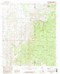
Skeleton Canyon, New Mexico, USGS topographic map dated 1987.
Includes geographic coordinates (latitude and longitude). This topographic map is suitable for hiking, camping, and exploring, or framing it as a wall map.
Printed on-demand using high resolution imagery, on heavy weight and acid free paper, or alternatively on a variety of synthetic materials.
Topos available on paper, Waterproof, Poly, or Tyvek. Usually shipping rolled, unless combined with other folded maps in one order.
- Product Number: USGS-5383977
- Free digital map download (high-resolution, GeoPDF): Skeleton Canyon, New Mexico (file size: 13 MB)
- Map Size: please refer to the dimensions of the GeoPDF map above
- Weight (paper map): ca. 55 grams
- Map Type: POD USGS Topographic Map
- Map Series: HTMC
- Map Verison: Historical
- Cell ID: 41575
- Scan ID: 194466
- Imprint Year: 1987
- Woodland Tint: Yes
- Aerial Photo Year: 1982
- Edit Year: 1987
- Field Check Year: 1983
- Datum: NAD27
- Map Projection: Transverse Mercator
- Provisional map: Yes
- Map published by United States Geological Survey
- Map Language: English
- Scanner Resolution: 600 dpi
- Map Cell Name: Skeleton Canyon
- Grid size: 7.5 X 7.5 Minute
- Date on map: 1987
- Map Scale: 1:24000
- Geographical region: New Mexico, United States
Neighboring Maps:
All neighboring USGS topo maps are available for sale online at a variety of scales.
Spatial coverage:
Topo map Skeleton Canyon, New Mexico, covers the geographical area associated the following places:
- Woodchoppers Spring - Rickys Tank - Cowboy Tank - Starvation Canyon - South Fork Skeleton Canyon - Hog Canyon Spring - Deer Creek Tank - Pine Canyon Tank - Pony Canyon - Skeleton Tank - Snure Ranch - Deer Flat - Clanton Canyon Tank - Salt Canyon - Starvation Tank - Devils Kitchen - Geronimo Surrender Site - Ben Tank - Mexican Tank - Smith Tank - Lower Skeleton Tank - Pine Canyon - Big Lake - Big Tank - New Tank - South Deer Creek - Whitmire Canyon Wilderness Study Area - Middle Deer Creek - Skeleton Canyon - Park Tank - Geronimo Tank - Patterson Tank
- Map Area ID: AREA31.62531.5-109.125-109
- Northwest corner Lat/Long code: USGSNW31.625-109.125
- Northeast corner Lat/Long code: USGSNE31.625-109
- Southwest corner Lat/Long code: USGSSW31.5-109.125
- Southeast corner Lat/Long code: USGSSE31.5-109
- Northern map edge Latitude: 31.625
- Southern map edge Latitude: 31.5
- Western map edge Longitude: -109.125
- Eastern map edge Longitude: -109


