
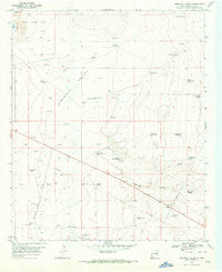
~ Simanola Valley NM topo map, 1:24000 scale, 7.5 X 7.5 Minute, Historical, 1970, updated 1972
Simanola Valley, New Mexico, USGS topographic map dated 1970.
Includes geographic coordinates (latitude and longitude). This topographic map is suitable for hiking, camping, and exploring, or framing it as a wall map.
Printed on-demand using high resolution imagery, on heavy weight and acid free paper, or alternatively on a variety of synthetic materials.
Topos available on paper, Waterproof, Poly, or Tyvek. Usually shipping rolled, unless combined with other folded maps in one order.
- Product Number: USGS-5383965
- Free digital map download (high-resolution, GeoPDF): Simanola Valley, New Mexico (file size: 7 MB)
- Map Size: please refer to the dimensions of the GeoPDF map above
- Weight (paper map): ca. 55 grams
- Map Type: POD USGS Topographic Map
- Map Series: HTMC
- Map Verison: Historical
- Cell ID: 41428
- Scan ID: 193076
- Imprint Year: 1972
- Aerial Photo Year: 1968
- Survey Year: 1970
- Datum: NAD27
- Map Projection: Polyconic
- Map published by United States Geological Survey
- Map Language: English
- Scanner Resolution: 600 dpi
- Map Cell Name: Simanola Valley
- Grid size: 7.5 X 7.5 Minute
- Date on map: 1970
- Map Scale: 1:24000
- Geographical region: New Mexico, United States
Neighboring Maps:
All neighboring USGS topo maps are available for sale online at a variety of scales.
Spatial coverage:
Topo map Simanola Valley, New Mexico, covers the geographical area associated the following places:
- 13392 Water Well - Tatum Division - 13408 Water Well - Northwest Windmill - 10779 Water Well - 10008 Water Well - 12707 Water Well - Middle Pasture Windmill - 10687 Water Well - East Horse Windmill - West Girl Windmill - 10691 Water Well - 10778 Water Well - 10692 Water Well - East Windmill - Middle Lake - South Pasture Windmill - 10702 Water Well - 12782 Water Well - 10693 Water Well - Jones Ranch - 10777 Water Well - 10689 Water Well - North Windmill - Badger Windmill - 10701 Water Well - Hill Pasture Middle Windmill - 10694 Water Well - Dripper Windmill - Shipper Pen Windmill - 12705 Water Well - House Lake - South Ninemile Windmill - Well Eightmile Windmill - 10686 Water Well - 12706 Water Well - 10696 Water Well - Rob Windmill - Four Lakes Area - North Pasture Windmill - Ranger Lake Oil Field - 13391 Water Well - Ninemile Windmill - Hill Pasture Top Windmill - 10780 Water Well - 10754 Water Well - Hill Pasture Bottom Windmill - 10695 Water Well
- Map Area ID: AREA33.37533.25-103.5-103.375
- Northwest corner Lat/Long code: USGSNW33.375-103.5
- Northeast corner Lat/Long code: USGSNE33.375-103.375
- Southwest corner Lat/Long code: USGSSW33.25-103.5
- Southeast corner Lat/Long code: USGSSE33.25-103.375
- Northern map edge Latitude: 33.375
- Southern map edge Latitude: 33.25
- Western map edge Longitude: -103.5
- Eastern map edge Longitude: -103.375


