
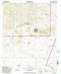
~ Sierra Fijardo NM topo map, 1:24000 scale, 7.5 X 7.5 Minute, Historical, 1995, updated 1998
Sierra Fijardo, New Mexico, USGS topographic map dated 1995.
Includes geographic coordinates (latitude and longitude). This topographic map is suitable for hiking, camping, and exploring, or framing it as a wall map.
Printed on-demand using high resolution imagery, on heavy weight and acid free paper, or alternatively on a variety of synthetic materials.
Topos available on paper, Waterproof, Poly, or Tyvek. Usually shipping rolled, unless combined with other folded maps in one order.
- Product Number: USGS-5383923
- Free digital map download (high-resolution, GeoPDF): Sierra Fijardo, New Mexico (file size: 12 MB)
- Map Size: please refer to the dimensions of the GeoPDF map above
- Weight (paper map): ca. 55 grams
- Map Type: POD USGS Topographic Map
- Map Series: HTMC
- Map Verison: Historical
- Cell ID: 41288
- Scan ID: 194443
- Imprint Year: 1998
- Woodland Tint: Yes
- Aerial Photo Year: 1992
- Field Check Year: 1995
- Survey Year: 1995
- Datum: NAD27
- Map Projection: Transverse Mercator
- Map published by United States Forest Service
- Map Language: English
- Scanner Resolution: 600 dpi
- Map Cell Name: Sierra Fijardo
- Grid size: 7.5 X 7.5 Minute
- Date on map: 1995
- Map Scale: 1:24000
- Geographical region: New Mexico, United States
Neighboring Maps:
All neighboring USGS topo maps are available for sale online at a variety of scales.
Spatial coverage:
Topo map Sierra Fijardo, New Mexico, covers the geographical area associated the following places:
- Marcus Tank - Flying X Ranch - Deer Springs Canyon - Flying X Water Well - Peñasco Spring - Street Canyon - Peñasco Canyon - Sierra Fijardo - Lighting Ridge - H Bierner Number 2 Reservoir - Whiskey Hill - Los Pillares Well - Aragon Draw - Ducknest Tank - Street Well - Sierras Mediano - Los Pillares - Flying X 2 Water Well - Rattlesnake Hill - Eagles Roost - Peñasco Peak - Los Tinajas - Deer Springs
- Map Area ID: AREA33.533.375-107.375-107.25
- Northwest corner Lat/Long code: USGSNW33.5-107.375
- Northeast corner Lat/Long code: USGSNE33.5-107.25
- Southwest corner Lat/Long code: USGSSW33.375-107.375
- Southeast corner Lat/Long code: USGSSE33.375-107.25
- Northern map edge Latitude: 33.5
- Southern map edge Latitude: 33.375
- Western map edge Longitude: -107.375
- Eastern map edge Longitude: -107.25


