
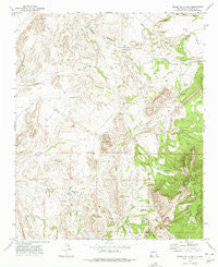
~ Sierra De La Cruz NM topo map, 1:24000 scale, 7.5 X 7.5 Minute, Historical, 1972, updated 1975
Sierra De La Cruz, New Mexico, USGS topographic map dated 1972.
Includes geographic coordinates (latitude and longitude). This topographic map is suitable for hiking, camping, and exploring, or framing it as a wall map.
Printed on-demand using high resolution imagery, on heavy weight and acid free paper, or alternatively on a variety of synthetic materials.
Topos available on paper, Waterproof, Poly, or Tyvek. Usually shipping rolled, unless combined with other folded maps in one order.
- Product Number: USGS-5383917
- Free digital map download (high-resolution, GeoPDF): Sierra De La Cruz, New Mexico (file size: 13 MB)
- Map Size: please refer to the dimensions of the GeoPDF map above
- Weight (paper map): ca. 55 grams
- Map Type: POD USGS Topographic Map
- Map Series: HTMC
- Map Verison: Historical
- Cell ID: 41286
- Scan ID: 193054
- Imprint Year: 1975
- Woodland Tint: Yes
- Aerial Photo Year: 1971
- Field Check Year: 1972
- Datum: NAD27
- Map Projection: Transverse Mercator
- Map published by United States Geological Survey
- Map Language: English
- Scanner Resolution: 600 dpi
- Map Cell Name: Sierra De La Cruz
- Grid size: 7.5 X 7.5 Minute
- Date on map: 1972
- Map Scale: 1:24000
- Geographical region: New Mexico, United States
Neighboring Maps:
All neighboring USGS topo maps are available for sale online at a variety of scales.
Spatial coverage:
Topo map Sierra De La Cruz, New Mexico, covers the geographical area associated the following places:
- Milagro Well - Buffalo Well - Stapleton Well - La Cebolla - Rancho Grande Well - Tomas Baca Well - Cibola Spring - Sierra de la Cruz - Partition Well - Buffalo Water Well - La Caida - Donnis Tank - Agua de los Torres - Valle de Adrian Tank - Gallina Well - Cuesta de la McBride - 10029 Water Well
- Map Area ID: AREA34.2534.125-106.75-106.625
- Northwest corner Lat/Long code: USGSNW34.25-106.75
- Northeast corner Lat/Long code: USGSNE34.25-106.625
- Southwest corner Lat/Long code: USGSSW34.125-106.75
- Southeast corner Lat/Long code: USGSSE34.125-106.625
- Northern map edge Latitude: 34.25
- Southern map edge Latitude: 34.125
- Western map edge Longitude: -106.75
- Eastern map edge Longitude: -106.625


