
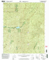
~ Mc Clure Reservoir NM topo map, 1:24000 scale, 7.5 X 7.5 Minute, Historical, 2002, updated 2003
Mc Clure Reservoir, New Mexico, USGS topographic map dated 2002.
Includes geographic coordinates (latitude and longitude). This topographic map is suitable for hiking, camping, and exploring, or framing it as a wall map.
Printed on-demand using high resolution imagery, on heavy weight and acid free paper, or alternatively on a variety of synthetic materials.
Topos available on paper, Waterproof, Poly, or Tyvek. Usually shipping rolled, unless combined with other folded maps in one order.
- Product Number: USGS-5381883
- Free digital map download (high-resolution, GeoPDF): Mc Clure Reservoir, New Mexico (file size: 18 MB)
- Map Size: please refer to the dimensions of the GeoPDF map above
- Weight (paper map): ca. 55 grams
- Map Type: POD USGS Topographic Map
- Map Series: HTMC
- Map Verison: Historical
- Cell ID: 28263
- Scan ID: 193956
- Imprint Year: 2003
- Woodland Tint: Yes
- Aerial Photo Year: 1996
- Edit Year: 2002
- Datum: NAD27
- Map Projection: Transverse Mercator
- Map published by United States Forest Service
- Map Language: English
- Scanner Resolution: 600 dpi
- Map Cell Name: McClure Reservoir
- Grid size: 7.5 X 7.5 Minute
- Date on map: 2002
- Map Scale: 1:24000
- Geographical region: New Mexico, United States
Neighboring Maps:
All neighboring USGS topo maps are available for sale online at a variety of scales.
Spatial coverage:
Topo map Mc Clure Reservoir, New Mexico, covers the geographical area associated the following places:
- Glorieta Baldy - Thompson Peak Trail - Chamiza Trail - McClure Dam - Glorieta Picnic Area - Granite Point Reservoir - Atalaya Trail - Hyde Memorial State Park - Thompson Peak - La Cueva Ridge - McClure Reservoir - Agua Sarca Creek - Sierra Pelada - Evergreen Lodge - Granite Point - Wild Horse Creek - Glorieta Baldy Lookout Tower Historic Site - Little Tesuque Camp - Monument Rock - Santa Fe Municipal Watershed - Black Canyon Forest Camp - Santiago Ramirez Grant
- Map Area ID: AREA35.7535.625-105.875-105.75
- Northwest corner Lat/Long code: USGSNW35.75-105.875
- Northeast corner Lat/Long code: USGSNE35.75-105.75
- Southwest corner Lat/Long code: USGSSW35.625-105.875
- Southeast corner Lat/Long code: USGSSE35.625-105.75
- Northern map edge Latitude: 35.75
- Southern map edge Latitude: 35.625
- Western map edge Longitude: -105.875
- Eastern map edge Longitude: -105.75


