
~ Hendricks Peak NM topo map, 1:24000 scale, 7.5 X 7.5 Minute, Historical, 1985, updated 1985
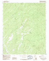
Hendricks Peak, New Mexico, USGS topographic map dated 1985.
Includes geographic coordinates (latitude and longitude). This topographic map is suitable for hiking, camping, and exploring, or framing it as a wall map.
Printed on-demand using high resolution imagery, on heavy weight and acid free paper, or alternatively on a variety of synthetic materials.
Topos available on paper, Waterproof, Poly, or Tyvek. Usually shipping rolled, unless combined with other folded maps in one order.
- Product Number: USGS-5380706
- Free digital map download (high-resolution, GeoPDF): Hendricks Peak, New Mexico (file size: 14 MB)
- Map Size: please refer to the dimensions of the GeoPDF map above
- Weight (paper map): ca. 55 grams
- Map Type: POD USGS Topographic Map
- Map Series: HTMC
- Map Verison: Historical
- Cell ID: 20096
- Scan ID: 192839
- Imprint Year: 1985
- Woodland Tint: Yes
- Aerial Photo Year: 1978
- Edit Year: 1985
- Field Check Year: 1979
- Datum: NAD27
- Map Projection: Transverse Mercator
- Provisional map: Yes
- Map published by United States Geological Survey
- Map Language: English
- Scanner Resolution: 600 dpi
- Map Cell Name: Hendricks Peak
- Grid size: 7.5 X 7.5 Minute
- Date on map: 1985
- Map Scale: 1:24000
- Geographical region: New Mexico, United States
Neighboring Maps:
All neighboring USGS topo maps are available for sale online at a variety of scales.
Spatial coverage:
Topo map Hendricks Peak, New Mexico, covers the geographical area associated the following places:
- Mud Springs Mountain - Horse Tank - Hendricks Peak - Rosencrans Tank - Lake Superior Tank - Juan Mesa Tank Number Two - Bear Canyon - Rays Tank - Bear Trap Canyon - Cabin Spring - Pothole Tank - City of Rocks - North Water Tank - Turkey Dam - Quaking Asp Canyon - Lower Well - Pit Tank - Girty Spring - Pit Tank - Skillet Mesa - Cureton Canyon - Valentine Spring - Juniper Tank - Trail Canyon Tank - Ridge Tank Number Two - Rabb Spring - East Tank - Trap Tank - JT Tank - Trap Spring - Upper Well - Gatlin Tank - Ott Tank - Stitzel Tank - Davis Tank - Valentine Canyon - Pasture Spring - Kelly Mesa Tank - Mimbres Division - Brushy Canyon - Nicholi Tank - Pale Tank - Bear Canyon Reservoir - Juan Mesa Tank - Aspen Spring - Race Spring - Little McKnight Canyon - Yates Spring Canyon - McKnight Well - Spring Canyon - Rabb Park - Bear Canyon Reservoir Dam - Water Canyon Tank - Dutchman Canyon - Kelly Ridge Tank - Dale Tank - Middle Tank - Rabb Canyon - East Canyon - Rosencran Canyon - Pence Tank - Dutchman Tank
- Map Area ID: AREA3332.875-108-107.875
- Northwest corner Lat/Long code: USGSNW33-108
- Northeast corner Lat/Long code: USGSNE33-107.875
- Southwest corner Lat/Long code: USGSSW32.875-108
- Southeast corner Lat/Long code: USGSSE32.875-107.875
- Northern map edge Latitude: 33
- Southern map edge Latitude: 32.875
- Western map edge Longitude: -108
- Eastern map edge Longitude: -107.875


