
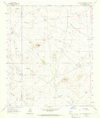
~ Cow Springs Mountain NM topo map, 1:24000 scale, 7.5 X 7.5 Minute, Historical, 1963, updated 1966
Cow Springs Mountain, New Mexico, USGS topographic map dated 1963.
Includes geographic coordinates (latitude and longitude). This topographic map is suitable for hiking, camping, and exploring, or framing it as a wall map.
Printed on-demand using high resolution imagery, on heavy weight and acid free paper, or alternatively on a variety of synthetic materials.
Topos available on paper, Waterproof, Poly, or Tyvek. Usually shipping rolled, unless combined with other folded maps in one order.
- Product Number: USGS-5379368
- Free digital map download (high-resolution, GeoPDF): Cow Springs Mountain, New Mexico (file size: 7 MB)
- Map Size: please refer to the dimensions of the GeoPDF map above
- Weight (paper map): ca. 55 grams
- Map Type: POD USGS Topographic Map
- Map Series: HTMC
- Map Verison: Historical
- Cell ID: 10439
- Scan ID: 190313
- Imprint Year: 1966
- Woodland Tint: Yes
- Aerial Photo Year: 1962
- Field Check Year: 1963
- Datum: NAD27
- Map Projection: Polyconic
- Map published by United States Geological Survey
- Map Language: English
- Scanner Resolution: 600 dpi
- Map Cell Name: Cow Springs Mountain
- Grid size: 7.5 X 7.5 Minute
- Date on map: 1963
- Map Scale: 1:24000
- Geographical region: New Mexico, United States
Neighboring Maps:
All neighboring USGS topo maps are available for sale online at a variety of scales.
Spatial coverage:
Topo map Cow Springs Mountain, New Mexico, covers the geographical area associated the following places:
- Hogback Tank - Oak Canyon - Bear Grass Hill - 01264 Water Well - 01265 Water Well - New Well - Number 1263 Water Well - Rattlesnake Tank - Cow Springs Windmill - Hay Meadow Windmill - Cow Springs Mountain - Trouble Windmill - Round Top Windmill - 01339 Water Well - Deep Well - Thorne Hay Draw Tank - White Rock Canyon - McDonald Draw - Childress Windmill - McDonald Hay Draw Tank - Childress Water Well - Trinity Ranch - Dave Smith Windmill - 01338 Water Well - Cow Springs Ranch
- Map Area ID: AREA32.532.375-108.25-108.125
- Northwest corner Lat/Long code: USGSNW32.5-108.25
- Northeast corner Lat/Long code: USGSNE32.5-108.125
- Southwest corner Lat/Long code: USGSSW32.375-108.25
- Southeast corner Lat/Long code: USGSSE32.375-108.125
- Northern map edge Latitude: 32.5
- Southern map edge Latitude: 32.375
- Western map edge Longitude: -108.25
- Eastern map edge Longitude: -108.125


