
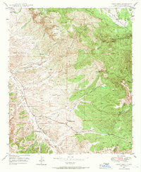
~ Circle Mesa NM topo map, 1:24000 scale, 7.5 X 7.5 Minute, Historical, 1949, updated 1966
Circle Mesa, New Mexico, USGS topographic map dated 1949.
Includes geographic coordinates (latitude and longitude). This topographic map is suitable for hiking, camping, and exploring, or framing it as a wall map.
Printed on-demand using high resolution imagery, on heavy weight and acid free paper, or alternatively on a variety of synthetic materials.
Topos available on paper, Waterproof, Poly, or Tyvek. Usually shipping rolled, unless combined with other folded maps in one order.
- Product Number: USGS-5379152
- Free digital map download (high-resolution, GeoPDF): Circle Mesa, New Mexico (file size: 16 MB)
- Map Size: please refer to the dimensions of the GeoPDF map above
- Weight (paper map): ca. 55 grams
- Map Type: POD USGS Topographic Map
- Map Series: HTMC
- Map Verison: Historical
- Cell ID: 8794
- Scan ID: 190199
- Imprint Year: 1966
- Woodland Tint: Yes
- Aerial Photo Year: 1945
- Field Check Year: 1949
- Datum: NAD27
- Map Projection: Polyconic
- Map published by United States Geological Survey
- Map Language: English
- Scanner Resolution: 600 dpi
- Map Cell Name: Circle Mesa
- Grid size: 7.5 X 7.5 Minute
- Date on map: 1949
- Map Scale: 1:24000
- Geographical region: New Mexico, United States
Neighboring Maps:
All neighboring USGS topo maps are available for sale online at a variety of scales.
Spatial coverage:
Topo map Circle Mesa, New Mexico, covers the geographical area associated the following places:
- Fleming Canyon - Ash Spring Canyon - Dorsey Mine - Cane Spring - New England - Alies Seep Canyon - Box Canyon - E McMillen Ranch - Circle Mesa - Cottonwood Canyon - Wake-Up-Charlie Mine - Alice Mine - Cane Spring Canyon - White Ranch - Barney Kerr Canyon - Allison Ranch - Treasure Mountain - Pauline Mine - Haystack Canyon - Franks 5 Water Well - Old Man Mine - Dud Tank - Old Woman Mine - Agua Alto Tank - McKeefer Canyon - Saddle Rock Canyon - Ash Spring - Sherman Ranch - J McMillen Ranch
- Map Area ID: AREA32.87532.75-108.5-108.375
- Northwest corner Lat/Long code: USGSNW32.875-108.5
- Northeast corner Lat/Long code: USGSNE32.875-108.375
- Southwest corner Lat/Long code: USGSSW32.75-108.5
- Southeast corner Lat/Long code: USGSSE32.75-108.375
- Northern map edge Latitude: 32.875
- Southern map edge Latitude: 32.75
- Western map edge Longitude: -108.5
- Eastern map edge Longitude: -108.375


