
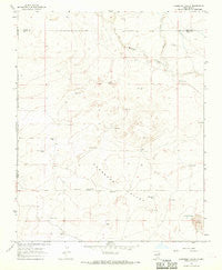
~ Cherokee Valley NM topo map, 1:24000 scale, 7.5 X 7.5 Minute, Historical, 1966, updated 1969
Cherokee Valley, New Mexico, USGS topographic map dated 1966.
Includes geographic coordinates (latitude and longitude). This topographic map is suitable for hiking, camping, and exploring, or framing it as a wall map.
Printed on-demand using high resolution imagery, on heavy weight and acid free paper, or alternatively on a variety of synthetic materials.
Topos available on paper, Waterproof, Poly, or Tyvek. Usually shipping rolled, unless combined with other folded maps in one order.
- Product Number: USGS-5379052
- Free digital map download (high-resolution, GeoPDF): Cherokee Valley, New Mexico (file size: 7 MB)
- Map Size: please refer to the dimensions of the GeoPDF map above
- Weight (paper map): ca. 55 grams
- Map Type: POD USGS Topographic Map
- Map Series: HTMC
- Map Verison: Historical
- Cell ID: 8347
- Scan ID: 190144
- Imprint Year: 1969
- Aerial Photo Year: 1965
- Field Check Year: 1966
- Datum: NAD27
- Map Projection: Polyconic
- Map published by United States Geological Survey
- Map Language: English
- Scanner Resolution: 600 dpi
- Map Cell Name: Cherokee Valley
- Grid size: 7.5 X 7.5 Minute
- Date on map: 1966
- Map Scale: 1:24000
- Geographical region: New Mexico, United States
Neighboring Maps:
All neighboring USGS topo maps are available for sale online at a variety of scales.
Spatial coverage:
Topo map Cherokee Valley, New Mexico, covers the geographical area associated the following places:
- 05325 Water Well - Garrett Well - 05319 Water Well - Cherokee Valley - Burks Ranch - Red Windmill - Arnold Well - 05328 Water Well - Stoner Well - 05324 Water Well - 05320 Water Well - 05326 Water Well - 05354 Water Well - Johnson - Kaufman Ranch - Van Wart Well - 05322 Water Well - Robertson - Johnson Ranch - 05340 Water Well - Faus Well - Cammack - Dessum Well - 05359 Water Well - South Well - North Fork Minneosa Creek - 05287 Water Well - Graveyard Well - Sand Hill Windmill - Haufman - 00202 Water Well - 05443 Water Well - Cherokee Valley Cemetery - Kuper - 05318 Water Well - 05442 Water Well - Campbell Well - Holcolm Well - Smith-Cox Well - 05286 Water Well - Waller Well - Alford Well - Johnson Well - Vandergrift Tank - 05321 Water Well - 05444 Water Well
- Map Area ID: AREA35.7535.625-103.375-103.25
- Northwest corner Lat/Long code: USGSNW35.75-103.375
- Northeast corner Lat/Long code: USGSNE35.75-103.25
- Southwest corner Lat/Long code: USGSSW35.625-103.375
- Southeast corner Lat/Long code: USGSSE35.625-103.25
- Northern map edge Latitude: 35.75
- Southern map edge Latitude: 35.625
- Western map edge Longitude: -103.375
- Eastern map edge Longitude: -103.25


