
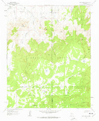
~ Cerro Parido NM topo map, 1:24000 scale, 7.5 X 7.5 Minute, Historical, 1961, updated 1963
Cerro Parido, New Mexico, USGS topographic map dated 1961.
Includes geographic coordinates (latitude and longitude). This topographic map is suitable for hiking, camping, and exploring, or framing it as a wall map.
Printed on-demand using high resolution imagery, on heavy weight and acid free paper, or alternatively on a variety of synthetic materials.
Topos available on paper, Waterproof, Poly, or Tyvek. Usually shipping rolled, unless combined with other folded maps in one order.
- Product Number: USGS-5379004
- Free digital map download (high-resolution, GeoPDF): Cerro Parido, New Mexico (file size: 10 MB)
- Map Size: please refer to the dimensions of the GeoPDF map above
- Weight (paper map): ca. 55 grams
- Map Type: POD USGS Topographic Map
- Map Series: HTMC
- Map Verison: Historical
- Cell ID: 69603
- Scan ID: 190113
- Imprint Year: 1963
- Woodland Tint: Yes
- Aerial Photo Year: 1958
- Field Check Year: 1961
- Datum: NAD27
- Map Projection: Polyconic
- Map published by United States Geological Survey
- Map Language: English
- Scanner Resolution: 600 dpi
- Map Cell Name: Cerro Parido
- Grid size: 7.5 X 7.5 Minute
- Date on map: 1961
- Map Scale: 1:24000
- Geographical region: New Mexico, United States
Neighboring Maps:
All neighboring USGS topo maps are available for sale online at a variety of scales.
Spatial coverage:
Topo map Cerro Parido, New Mexico, covers the geographical area associated the following places:
- R-13 Water Well - Heifer Tank - Bear Mouth - Ojo de Alamo - Mesa la Azabache - Cerro Parido - Ernest Montoya Ranch - Laguna Blanca - Ignacio Chavez Grant - Toruno Spring - Rincon Entranosa - Barrel Spring - El Banquito - Seco Tank - 10017 Water Well - Sandoval Ranch - Ojo Azabache - Cerro Pelon - Coal Spring - Ned Tank - Toro Tank - Laguna Cuarenta - Salado Spring - Cerrito del Relampago - Joe Montoya Ranch
- Map Area ID: AREA35.62535.5-107.375-107.25
- Northwest corner Lat/Long code: USGSNW35.625-107.375
- Northeast corner Lat/Long code: USGSNE35.625-107.25
- Southwest corner Lat/Long code: USGSSW35.5-107.375
- Southeast corner Lat/Long code: USGSSE35.5-107.25
- Northern map edge Latitude: 35.625
- Southern map edge Latitude: 35.5
- Western map edge Longitude: -107.375
- Eastern map edge Longitude: -107.25


