
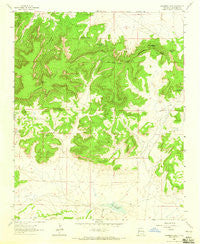
~ Casamero Lake NM topo map, 1:24000 scale, 7.5 X 7.5 Minute, Historical, 1963, updated 1965
Casamero Lake, New Mexico, USGS topographic map dated 1963.
Includes geographic coordinates (latitude and longitude). This topographic map is suitable for hiking, camping, and exploring, or framing it as a wall map.
Printed on-demand using high resolution imagery, on heavy weight and acid free paper, or alternatively on a variety of synthetic materials.
Topos available on paper, Waterproof, Poly, or Tyvek. Usually shipping rolled, unless combined with other folded maps in one order.
- Product Number: USGS-5378900
- Free digital map download (high-resolution, GeoPDF): Casamero Lake, New Mexico (file size: 11 MB)
- Map Size: please refer to the dimensions of the GeoPDF map above
- Weight (paper map): ca. 55 grams
- Map Type: POD USGS Topographic Map
- Map Series: HTMC
- Map Verison: Historical
- Cell ID: 7494
- Scan ID: 190069
- Imprint Year: 1965
- Woodland Tint: Yes
- Aerial Photo Year: 1958
- Field Check Year: 1963
- Datum: NAD27
- Map Projection: Polyconic
- Map published by United States Geological Survey
- Map Language: English
- Scanner Resolution: 600 dpi
- Map Cell Name: Casamero Lake
- Grid size: 7.5 X 7.5 Minute
- Date on map: 1963
- Map Scale: 1:24000
- Geographical region: New Mexico, United States
Neighboring Maps:
All neighboring USGS topo maps are available for sale online at a variety of scales.
Spatial coverage:
Topo map Casamero Lake, New Mexico, covers the geographical area associated the following places:
- Blue Water Spring - Casamero Lake Chapter - Many Mexican Spring - Casamero Lake - White Water Mesa - 16B-37 Water Well - Wheat Grass Pass - Rocky Point - Uranium Deposit - Long Canyon - Red Butte - 10014 Water Well - Little Water Spring - Owl Spring - Big Point - Wheat Grass Butte - 16T-594 Water Well - Cream Colored Rock - Borrego Pass Trading Post - 16T-597 Water Well - 10018 Water Well - 16T588 Water Well - Tiejen Prospect - The Cup
- Map Area ID: AREA35.62535.5-108.125-108
- Northwest corner Lat/Long code: USGSNW35.625-108.125
- Northeast corner Lat/Long code: USGSNE35.625-108
- Southwest corner Lat/Long code: USGSSW35.5-108.125
- Southeast corner Lat/Long code: USGSSE35.5-108
- Northern map edge Latitude: 35.625
- Southern map edge Latitude: 35.5
- Western map edge Longitude: -108.125
- Eastern map edge Longitude: -108


