
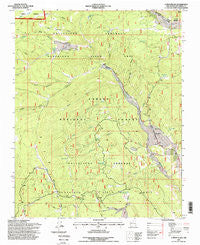
~ Canon Plaza NM topo map, 1:24000 scale, 7.5 X 7.5 Minute, Historical, 1995, updated 1998
Canon Plaza, New Mexico, USGS topographic map dated 1995.
Includes geographic coordinates (latitude and longitude). This topographic map is suitable for hiking, camping, and exploring, or framing it as a wall map.
Printed on-demand using high resolution imagery, on heavy weight and acid free paper, or alternatively on a variety of synthetic materials.
Topos available on paper, Waterproof, Poly, or Tyvek. Usually shipping rolled, unless combined with other folded maps in one order.
- Product Number: USGS-5378756
- Free digital map download (high-resolution, GeoPDF): Canon Plaza, New Mexico (file size: 13 MB)
- Map Size: please refer to the dimensions of the GeoPDF map above
- Weight (paper map): ca. 55 grams
- Map Type: POD USGS Topographic Map
- Map Series: HTMC
- Map Verison: Historical
- Cell ID: 7092
- Scan ID: 192422
- Imprint Year: 1998
- Woodland Tint: Yes
- Aerial Photo Year: 1990
- Field Check Year: 1995
- Datum: NAD27
- Map Projection: Transverse Mercator
- Map published by United States Forest Service
- Map Language: English
- Scanner Resolution: 600 dpi
- Map Cell Name: Canon Plaza
- Grid size: 7.5 X 7.5 Minute
- Date on map: 1995
- Map Scale: 1:24000
- Geographical region: New Mexico, United States
Neighboring Maps:
All neighboring USGS topo maps are available for sale online at a variety of scales.
Spatial coverage:
Topo map Canon Plaza, New Mexico, covers the geographical area associated the following places:
- Arroyo Plaza Tank - Jacques Canyon Tank Number 2 - Cañada Escondia - Cañada Gallina - Cañada Escondida - Cañon Plaza - Cañon de los Posos - El Ritito Campground - La Jara Canyon - Cañada Alamosa - Cañada Llaves - La Manga Canyon - La Jara Canyon Tank - Escondida Canyon Tank - Ensenada Lake - Valle de los Caballos - Cañada Jacques - Jaramillo Ranch (historical) - La Manga Tank - Valle Grande Trail - Ritito Canyon - Cañada de Oso - Burro Tank - Jacques Canyon Tank Number 1 - Cañada Escondida Tank - Rock Tank - Cañada Burro - Hondo Canyon - Felipito Canyon - El Ritito Tank - Valle Diablo Tank - Ojito Escondido Canyon - Bonita Canyon
- Map Area ID: AREA36.62536.5-106.25-106.125
- Northwest corner Lat/Long code: USGSNW36.625-106.25
- Northeast corner Lat/Long code: USGSNE36.625-106.125
- Southwest corner Lat/Long code: USGSSW36.5-106.25
- Southeast corner Lat/Long code: USGSSE36.5-106.125
- Northern map edge Latitude: 36.625
- Southern map edge Latitude: 36.5
- Western map edge Longitude: -106.25
- Eastern map edge Longitude: -106.125


