
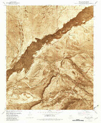
~ Bull Gap NM topo map, 1:24000 scale, 7.5 X 7.5 Minute, Historical, 1981, updated 1982
Bull Gap, New Mexico, USGS topographic map dated 1981.
Includes geographic coordinates (latitude and longitude). This topographic map is suitable for hiking, camping, and exploring, or framing it as a wall map.
Printed on-demand using high resolution imagery, on heavy weight and acid free paper, or alternatively on a variety of synthetic materials.
Topos available on paper, Waterproof, Poly, or Tyvek. Usually shipping rolled, unless combined with other folded maps in one order.
- Product Number: USGS-5378564
- Free digital map download (high-resolution, GeoPDF): Bull Gap, New Mexico (file size: 19 MB)
- Map Size: please refer to the dimensions of the GeoPDF map above
- Weight (paper map): ca. 55 grams
- Map Type: POD USGS Topographic Map
- Map Series: HTMC
- Map Verison: Historical
- Cell ID: 6125
- Scan ID: 189900
- Imprint Year: 1982
- Aerial Photo Year: 1972
- Edit Year: 1981
- Field Check Year: 1975
- Datum: NAD27
- Map Projection: Transverse Mercator
- Orthophoto: Map
- Map published by United States Geological Survey
- Map Language: English
- Scanner Resolution: 600 dpi
- Map Cell Name: Bull Gap
- Grid size: 7.5 X 7.5 Minute
- Date on map: 1981
- Map Scale: 1:24000
- Geographical region: New Mexico, United States
Neighboring Maps:
All neighboring USGS topo maps are available for sale online at a variety of scales.
Spatial coverage:
Topo map Bull Gap, New Mexico, covers the geographical area associated the following places:
- Oscura - Bull Gap Tank - George McDonald Well - Oscura Coal Mine - Sprole Ranch - Rim Rock Canyon - Twin Tanks - Clark Well - Highway Tank - Willow Draw - Cattle Guard Well - Lower Willow Spring - A A A Tank - Bull Gap Canyon - Rim Rock Well - Root Spring - 10001 Water Well - Willow Springs - Branum Well - Dalton Spring - The Malpais - Rim Rock Water Well - Pipe Line Well - Cottonwood Creek - Craven Well - Bull Gap Spring
- Map Area ID: AREA33.62533.5-106.125-106
- Northwest corner Lat/Long code: USGSNW33.625-106.125
- Northeast corner Lat/Long code: USGSNE33.625-106
- Southwest corner Lat/Long code: USGSSW33.5-106.125
- Southeast corner Lat/Long code: USGSSE33.5-106
- Northern map edge Latitude: 33.625
- Southern map edge Latitude: 33.5
- Western map edge Longitude: -106.125
- Eastern map edge Longitude: -106


