
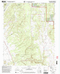
~ Bull Canyon NM topo map, 1:24000 scale, 7.5 X 7.5 Minute, Historical, 2002, updated 2003
Bull Canyon, New Mexico, USGS topographic map dated 2002.
Includes geographic coordinates (latitude and longitude). This topographic map is suitable for hiking, camping, and exploring, or framing it as a wall map.
Printed on-demand using high resolution imagery, on heavy weight and acid free paper, or alternatively on a variety of synthetic materials.
Topos available on paper, Waterproof, Poly, or Tyvek. Usually shipping rolled, unless combined with other folded maps in one order.
- Product Number: USGS-5378560
- Free digital map download (high-resolution, GeoPDF): Bull Canyon, New Mexico (file size: 12 MB)
- Map Size: please refer to the dimensions of the GeoPDF map above
- Weight (paper map): ca. 55 grams
- Map Type: POD USGS Topographic Map
- Map Series: HTMC
- Map Verison: Historical
- Cell ID: 6112
- Scan ID: 193861
- Imprint Year: 2003
- Woodland Tint: Yes
- Aerial Photo Year: 1996
- Edit Year: 2002
- Datum: NAD27
- Map Projection: Transverse Mercator
- Map published by United States Forest Service
- Map Language: English
- Scanner Resolution: 600 dpi
- Map Cell Name: Bull Canyon
- Grid size: 7.5 X 7.5 Minute
- Date on map: 2002
- Map Scale: 1:24000
- Geographical region: New Mexico, United States
Neighboring Maps:
All neighboring USGS topo maps are available for sale online at a variety of scales.
Spatial coverage:
Topo map Bull Canyon, New Mexico, covers the geographical area associated the following places:
- Ojo Abajeños - Bull Canyon - Elsie Well - Padre Spring Creek - Bull Canyon Well - Elsie Windmill - Arroyo Salado - Pueblo San Cristoval - Sarapio Tank - Ojo de Vaca Cemetery - Cow Spring Well - Bobcat Canyon - Cow Spring Windmill - Ortega Creek - Cañada Colorado - Ojo Tank - Chavez Tanks - Ojo de la Vaca - San Cristobal Ranch - Cañada de la Vaca - Ojo de la Vaca Windmill - Bull Canyon Windmill - Piedra Lumbre Windmill - San Miguelito Cemetery - Bar S Ranch - Salado Tank - Water Well 10207 - Bishop John Lamy Grant - Isaque Tank - Cow Spring Water Well - Pine Canyon - Horse Tank - Elsie Well
- Map Area ID: AREA35.535.375-105.875-105.75
- Northwest corner Lat/Long code: USGSNW35.5-105.875
- Northeast corner Lat/Long code: USGSNE35.5-105.75
- Southwest corner Lat/Long code: USGSSW35.375-105.875
- Southeast corner Lat/Long code: USGSSE35.375-105.75
- Northern map edge Latitude: 35.5
- Southern map edge Latitude: 35.375
- Western map edge Longitude: -105.875
- Eastern map edge Longitude: -105.75


