
~ Bonner Lake NM topo map, 1:24000 scale, 7.5 X 7.5 Minute, Historical, 1968, updated 1971
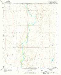
Bonner Lake, New Mexico, USGS topographic map dated 1968.
Includes geographic coordinates (latitude and longitude). This topographic map is suitable for hiking, camping, and exploring, or framing it as a wall map.
Printed on-demand using high resolution imagery, on heavy weight and acid free paper, or alternatively on a variety of synthetic materials.
Topos available on paper, Waterproof, Poly, or Tyvek. Usually shipping rolled, unless combined with other folded maps in one order.
- Product Number: USGS-5378438
- Free digital map download (high-resolution, GeoPDF): Bonner Lake, New Mexico (file size: 7 MB)
- Map Size: please refer to the dimensions of the GeoPDF map above
- Weight (paper map): ca. 55 grams
- Map Type: POD USGS Topographic Map
- Map Series: HTMC
- Map Verison: Historical
- Cell ID: 4812
- Scan ID: 189837
- Imprint Year: 1971
- Woodland Tint: Yes
- Aerial Photo Year: 1967
- Field Check Year: 1968
- Datum: NAD27
- Map Projection: Polyconic
- Map published by United States Geological Survey
- Map Language: English
- Scanner Resolution: 600 dpi
- Map Cell Name: Bonner Lake
- Grid size: 7.5 X 7.5 Minute
- Date on map: 1968
- Map Scale: 1:24000
- Geographical region: New Mexico, United States
Neighboring Maps:
All neighboring USGS topo maps are available for sale online at a variety of scales.
Spatial coverage:
Topo map Bonner Lake, New Mexico, covers the geographical area associated the following places:
- 10116 Water Well - Cibolo Creek - 10100 Water Well - 10088 Water Well - 10030 Water Well - Mesita Negra - 10000 Water Well - Cañon Blanco - Fort Sumner Valley - 10099 Water Well - 10105 Water Well - 20000 Water Well - East De Baca Division - 10096 Water Well - 10104 Water Well - 10090 Water Well - Bonner Lake - 10094 Water Well - 10114 Water Well - 10091 Water Well - 10001 Water Well - 10101 Water Well - 10851 Water Well - 10097 Water Well - 10102 Water Well - 10111 Water Well - 10093 Water Well - 10209 Water Well - 10115 Water Well - Ricardo Volunteer Fire Department - 10092 Water Well - 10107 Water Well - 10112 Water Well - 10103 Water Well - 10108 Water Well - 10110 Water Well - Taiban Creek - 10208 Water Well - 10095 Water Well
- Map Area ID: AREA34.37534.25-104.25-104.125
- Northwest corner Lat/Long code: USGSNW34.375-104.25
- Northeast corner Lat/Long code: USGSNE34.375-104.125
- Southwest corner Lat/Long code: USGSSW34.25-104.25
- Southeast corner Lat/Long code: USGSSE34.25-104.125
- Northern map edge Latitude: 34.375
- Southern map edge Latitude: 34.25
- Western map edge Longitude: -104.25
- Eastern map edge Longitude: -104.125


