
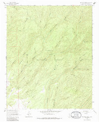
~ Bay Buck Peaks NM topo map, 1:24000 scale, 7.5 X 7.5 Minute, Historical, 1964, updated 1986
Bay Buck Peaks, New Mexico, USGS topographic map dated 1964.
Includes geographic coordinates (latitude and longitude). This topographic map is suitable for hiking, camping, and exploring, or framing it as a wall map.
Printed on-demand using high resolution imagery, on heavy weight and acid free paper, or alternatively on a variety of synthetic materials.
Topos available on paper, Waterproof, Poly, or Tyvek. Usually shipping rolled, unless combined with other folded maps in one order.
- Product Number: USGS-5378152
- Free digital map download (high-resolution, GeoPDF): Bay Buck Peaks, New Mexico (file size: 13 MB)
- Map Size: please refer to the dimensions of the GeoPDF map above
- Weight (paper map): ca. 55 grams
- Map Type: POD USGS Topographic Map
- Map Series: HTMC
- Map Verison: Historical
- Cell ID: 2695
- Scan ID: 193783
- Imprint Year: 1986
- Woodland Tint: Yes
- Aerial Photo Year: 1960
- Field Check Year: 1964
- Datum: NAD27
- Map Projection: Polyconic
- Map published by United States Geological Survey
- Map Language: English
- Scanner Resolution: 600 dpi
- Map Cell Name: Bay Buck Peaks
- Grid size: 7.5 X 7.5 Minute
- Date on map: 1964
- Map Scale: 1:24000
- Geographical region: New Mexico, United States
Neighboring Maps:
All neighboring USGS topo maps are available for sale online at a variety of scales.
Spatial coverage:
Topo map Bay Buck Peaks, New Mexico, covers the geographical area associated the following places:
- Indian Canyon - Trough Spring - Bear Canyon - Bear Trap Corral - Sawmill Canyon - Bitter Creek Tank - Scrapes Windmill - Foster Draw - Roberts Place Tank - Bay Buck Peaks - Panther Canyon - Mouth of Bear Ranch - Burnt Canyon - Baney Park Canyon - Bull Canyon - Spring Hollow Canyon - Tin Cup Canyon - Alexander Mountain - Turkey Saddle - Bear Trap Canyon - Bitter Canyon - Chimney Canyon - Hay Ground Draw - Dodson Canyon - Pinnacle Canyon - Deer Spring Canyon - Wallace Trough Canyon - Baney Park Tank - Boulder Tank - Hughes Campground - Pigeon Tank - Buck Canyon - Spring Canyon - Fisher Canyon - Turkey Creek
- Map Area ID: AREA33.87533.75-107.625-107.5
- Northwest corner Lat/Long code: USGSNW33.875-107.625
- Northeast corner Lat/Long code: USGSNE33.875-107.5
- Southwest corner Lat/Long code: USGSSW33.75-107.625
- Southeast corner Lat/Long code: USGSSE33.75-107.5
- Northern map edge Latitude: 33.875
- Southern map edge Latitude: 33.75
- Western map edge Longitude: -107.625
- Eastern map edge Longitude: -107.5


