
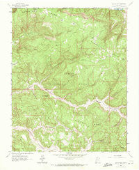
~ Bancos Mesa NM topo map, 1:24000 scale, 7.5 X 7.5 Minute, Historical, 1963, updated 1972
Bancos Mesa, New Mexico, USGS topographic map dated 1963.
Includes geographic coordinates (latitude and longitude). This topographic map is suitable for hiking, camping, and exploring, or framing it as a wall map.
Printed on-demand using high resolution imagery, on heavy weight and acid free paper, or alternatively on a variety of synthetic materials.
Topos available on paper, Waterproof, Poly, or Tyvek. Usually shipping rolled, unless combined with other folded maps in one order.
- Product Number: USGS-5378120
- Free digital map download (high-resolution, GeoPDF): Bancos Mesa, New Mexico (file size: 13 MB)
- Map Size: please refer to the dimensions of the GeoPDF map above
- Weight (paper map): ca. 55 grams
- Map Type: POD USGS Topographic Map
- Map Series: HTMC
- Map Verison: Historical
- Cell ID: 2303
- Scan ID: 189679
- Imprint Year: 1972
- Woodland Tint: Yes
- Aerial Photo Year: 1962
- Field Check Year: 1963
- Datum: NAD27
- Map Projection: Polyconic
- Map published by United States Geological Survey
- Map Language: English
- Scanner Resolution: 600 dpi
- Map Cell Name: Bancos Mesa
- Grid size: 7.5 X 7.5 Minute
- Date on map: 1963
- Map Scale: 1:24000
- Geographical region: New Mexico, United States
Neighboring Maps:
All neighboring USGS topo maps are available for sale online at a variety of scales.
Spatial coverage:
Topo map Bancos Mesa, New Mexico, covers the geographical area associated the following places:
- Cañon Pintado - Alamo Tank - Eula Canyon - Rincon Quemado - Saltero Canyon - Velasquez Spring - Quintana Mesa - Anselmo Bench - Cottonwood Canyon - Devils Canyon - Cañon Cedro - Carracas Cemetery - Tio Quinto Canyon - Middle Mesa - Alamo Canyon - Orcones Canyon - Martinez Canyon - Horse Tank - Carracas Mesa - Cedar Rock - Eul Point - Carracas Rim - Gurule Canyon - Box Tank - Pecho de la Doncella - Bancos Mesa - Wild Horse Canyon - Peters Canyon - Sanchez Tank - Log Tank - Chavez Tank
- Map Area ID: AREA3736.875-107.375-107.25
- Northwest corner Lat/Long code: USGSNW37-107.375
- Northeast corner Lat/Long code: USGSNE37-107.25
- Southwest corner Lat/Long code: USGSSW36.875-107.375
- Southeast corner Lat/Long code: USGSSE36.875-107.25
- Northern map edge Latitude: 37
- Southern map edge Latitude: 36.875
- Western map edge Longitude: -107.375
- Eastern map edge Longitude: -107.25


