
~ Angel Draw NM topo map, 1:24000 scale, 7.5 X 7.5 Minute, Historical, 1985, updated 1985
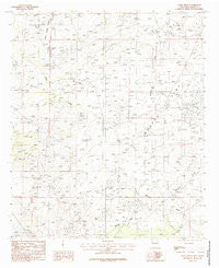
Angel Draw, New Mexico, USGS topographic map dated 1985.
Includes geographic coordinates (latitude and longitude). This topographic map is suitable for hiking, camping, and exploring, or framing it as a wall map.
Printed on-demand using high resolution imagery, on heavy weight and acid free paper, or alternatively on a variety of synthetic materials.
Topos available on paper, Waterproof, Poly, or Tyvek. Usually shipping rolled, unless combined with other folded maps in one order.
- Product Number: USGS-5377896
- Free digital map download (high-resolution, GeoPDF): Angel Draw, New Mexico (file size: 9 MB)
- Map Size: please refer to the dimensions of the GeoPDF map above
- Weight (paper map): ca. 55 grams
- Map Type: POD USGS Topographic Map
- Map Series: HTMC
- Map Verison: Historical
- Cell ID: 1025
- Scan ID: 193716
- Imprint Year: 1985
- Woodland Tint: Yes
- Aerial Photo Year: 1977
- Edit Year: 1985
- Field Check Year: 1978
- Datum: NAD27
- Map Projection: Transverse Mercator
- Provisional map: Yes
- Map published by United States Geological Survey
- Map Language: English
- Scanner Resolution: 600 dpi
- Map Cell Name: Angel Draw
- Grid size: 7.5 X 7.5 Minute
- Date on map: 1985
- Map Scale: 1:24000
- Geographical region: New Mexico, United States
Neighboring Maps:
All neighboring USGS topo maps are available for sale online at a variety of scales.
Spatial coverage:
Topo map Angel Draw, New Mexico, covers the geographical area associated the following places:
- Murray West Well - 06442 Water Well - 06434 Water Well - 06705 Water Well - 06703 Water Well - 06440 Water Well - Saladar Flat - Burton Flat - Bates Ranch - Indian Hill - 06704 Water Well - Murray Ranch - Alkali Lake - 12179 Water Well - 06706 Water Well - 06443 Water Well - 00817 Water Well - 12178 Water Well - 06439 Water Well - 06437 Water Well - 06441 Water Well - Scanlon Draw - Angel Draw - 06707 Water Well - 06708 Water Well - 06438 Water Well - Angel Ranch - 06436 Water Well - 06435 Water Well
- Map Area ID: AREA32.62532.5-104.25-104.125
- Northwest corner Lat/Long code: USGSNW32.625-104.25
- Northeast corner Lat/Long code: USGSNE32.625-104.125
- Southwest corner Lat/Long code: USGSSW32.5-104.25
- Southeast corner Lat/Long code: USGSSE32.5-104.125
- Northern map edge Latitude: 32.625
- Southern map edge Latitude: 32.5
- Western map edge Longitude: -104.25
- Eastern map edge Longitude: -104.125


