
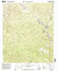
~ Allie Canyon NM topo map, 1:24000 scale, 7.5 X 7.5 Minute, Historical, 1999, updated 2002
Allie Canyon, New Mexico, USGS topographic map dated 1999.
Includes geographic coordinates (latitude and longitude). This topographic map is suitable for hiking, camping, and exploring, or framing it as a wall map.
Printed on-demand using high resolution imagery, on heavy weight and acid free paper, or alternatively on a variety of synthetic materials.
Topos available on paper, Waterproof, Poly, or Tyvek. Usually shipping rolled, unless combined with other folded maps in one order.
- Product Number: USGS-5377856
- Free digital map download (high-resolution, GeoPDF): Allie Canyon, New Mexico (file size: 15 MB)
- Map Size: please refer to the dimensions of the GeoPDF map above
- Weight (paper map): ca. 55 grams
- Map Type: POD USGS Topographic Map
- Map Series: HTMC
- Map Verison: Historical
- Cell ID: 633
- Scan ID: 193706
- Imprint Year: 2002
- Woodland Tint: Yes
- Aerial Photo Year: 1996
- Edit Year: 2000
- Datum: NAD27
- Map Projection: Transverse Mercator
- Map published by United States Forest Service
- Map Language: English
- Scanner Resolution: 600 dpi
- Map Cell Name: Allie Canyon
- Grid size: 7.5 X 7.5 Minute
- Date on map: 1999
- Map Scale: 1:24000
- Geographical region: New Mexico, United States
Neighboring Maps:
All neighboring USGS topo maps are available for sale online at a variety of scales.
Spatial coverage:
Topo map Allie Canyon, New Mexico, covers the geographical area associated the following places:
- Camp Thunderbird - Divide Well - B and P Tank - Gooseman Tank - Mitchell Tank - Little Bear Spring - Telephone Tank - NMBS RG ST Water Well - T-Eleven Tank - Brushy Basin Tank - Soldiers Canyon - Cottonwood Tank - Cabin Spring - Continental Tank - 00009 Water Well - Steer Tank - West Fork Mimbres River - Mimbres Canyon - 00012 Water Well - G O S Ranch - Camp Thunderbird Campground - Corner Spring - Gos Organizational Site - First Water Spring - 00010 Water Well - Three Circle Canyon - Mesa Tank - Spring Canyon - Deemer Canyon - Divide Well - Deadman Canyon - McCoy Tank - Oscar Tank - Redgate Corral - Water Canyon - Cottonwood Canyon - Lincoln Canyon - Hightower Canyon - East Fork Mimbres River - Unknown Tank - Hicks Cemetery - West Skates Canyon - Elk Pasture Tank - Allie Canyon - Powderhorn Canyon - Mimbres District Ranger Station - Circle Well - Gattons Park - Laney Spring - Soldier Spring - 00011 Water Well - McKnight Canyon - Allie Well - Shingle Tank - Slash Tank - Camp Thunder Bird Upper Mimbres Substation 2 - Upper Cottonwood Spring - Lower Elk Tank - Jackass Canyon
- Map Area ID: AREA3332.875-108.125-108
- Northwest corner Lat/Long code: USGSNW33-108.125
- Northeast corner Lat/Long code: USGSNE33-108
- Southwest corner Lat/Long code: USGSSW32.875-108.125
- Southeast corner Lat/Long code: USGSSE32.875-108
- Northern map edge Latitude: 33
- Southern map edge Latitude: 32.875
- Western map edge Longitude: -108.125
- Eastern map edge Longitude: -108


