
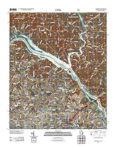
~ Martinez GA topo map, 1:24000 scale, 7.5 X 7.5 Minute, Historical, 2011
Martinez, Georgia, USGS topographic map dated 2011.
Includes geographic coordinates (latitude and longitude). This topographic map is suitable for hiking, camping, and exploring, or framing it as a wall map.
Printed on-demand using high resolution imagery, on heavy weight and acid free paper, or alternatively on a variety of synthetic materials.
Topos available on paper, Waterproof, Poly, or Tyvek. Usually shipping rolled, unless combined with other folded maps in one order.
- Product Number: USGS-5377658
- Free digital map download (high-resolution, GeoPDF): Martinez, Georgia (file size: 25 MB)
- Map Size: please refer to the dimensions of the GeoPDF map above
- Weight (paper map): ca. 55 grams
- Map Type: POD USGS Topographic Map
- Map Series: US Topo
- Map Verison: Historical
- Cell ID: 27887
- Datum: North American Datum of 1983
- Map Projection: Transverse Mercator
- Map Cell Name: Martinez
- Grid size: 7.5 X 7.5 Minute
- Date on map: 2011
- Map Scale: 1:24000
- Geographical region: Georgia, United States
Neighboring Maps:
All neighboring USGS topo maps are available for sale online at a variety of scales.
Spatial coverage:
Topo map Martinez, Georgia, covers the geographical area associated the following places:
- New Richmond (historical) - Foxhall - Wynngate - Holiday Park - Woodland - Windsor Forest - Lulaville - West Lynne - Edgewood - Poverty Hill - Bristol Wood - Brookfield West - Phillips Estates - Candlewood Crossing - Mayo - Beverly Heights - Forest Creek - Bonaire Heights - Village at Watervale - Casa Bella - Jushua Tree Villas - Martinez - Crofton - Memory Park - Bonair - Windsor Court - Stevens Creek - Shenandoah - Petersburg Station - Dorchester - Jamaica Estates - Maysville (historical) - Farmington - Stevens Pointe - Creek View - Cambridge - Watervale - Stallings Place - Stevens Creek West - Westlake - Sterling Heights - Gaines Court - Lenoir (historical) - Huntington - Avondale - Village West - West Hills - Morgana - Montclair - Westwood - Fernbrook - Kennelworth - Spring Lakes - Shenandoah Woods - Snead - Briarwood - Columbia Heights - Forest Park - National Hills - Lamkin - Westport - Casa Linda - West Hampton - Evans Mill - Sweetbriar
- Map Area ID: AREA33.62533.5-82.125-82
- Northwest corner Lat/Long code: USGSNW33.625-82.125
- Northeast corner Lat/Long code: USGSNE33.625-82
- Southwest corner Lat/Long code: USGSSW33.5-82.125
- Southeast corner Lat/Long code: USGSSE33.5-82
- Northern map edge Latitude: 33.625
- Southern map edge Latitude: 33.5
- Western map edge Longitude: -82.125
- Eastern map edge Longitude: -82


