
~ Newark NJ topo map, 1:250000 scale, 1 X 2 Degree, Historical, 1944, updated 1986
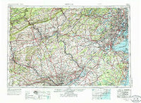
Newark, New Jersey, USGS topographic map dated 1944.
Includes geographic coordinates (latitude and longitude). This topographic map is suitable for hiking, camping, and exploring, or framing it as a wall map.
Printed on-demand using high resolution imagery, on heavy weight and acid free paper, or alternatively on a variety of synthetic materials.
Topos available on paper, Waterproof, Poly, or Tyvek. Usually shipping rolled, unless combined with other folded maps in one order.
- Product Number: USGS-5377656
- Free digital map download (high-resolution, GeoPDF): Newark, New Jersey (file size: 26 MB)
- Map Size: please refer to the dimensions of the GeoPDF map above
- Weight (paper map): ca. 55 grams
- Map Type: POD USGS Topographic Map
- Map Series: HTMC
- Map Verison: Historical
- Cell ID: 68933
- Scan ID: 255463
- Imprint Year: 1986
- Woodland Tint: Yes
- Visual Version Number: 2
- Photo Revision Year: 1969
- Aerial Photo Year: 1944
- Edit Year: 1969
- Datum: Unstated
- Map Projection: Transverse Mercator
- Map published by United States Geological Survey
- Map Language: English
- Scanner Resolution: 600 dpi
- Map Cell Name: Newark
- Grid size: 1 X 2 Degree
- Date on map: 1944
- Map Scale: 1:250000
- Geographical region: New Jersey, United States
Neighboring Maps:
All neighboring USGS topo maps are available for sale online at a variety of scales.
Spatial coverage:
Topo map Newark, New Jersey, covers the geographical area associated the following places:
- East Oak Lane - Wyndmoor - Scherersville - Pleasantview - Lederach - Ryans Corner - Manasquan Park - Keelersville - Squankum - Nazareth - Krumsville - Andover Junction - Clayton - Clearfield - Minesite - Kresgeville - Abington - Whiteland Crest - Lahiere - Sours Mills - Morsemere - Locust Corner - Melrose Park - Sharper - Somerset Park - Warwick - Winding Brook Estates - Cedar Knolls - Ardmore - Sayreville Station - Cynwyd Estates - Allentown - Montgomery Greeny - Milltown - Port Morris - Centennial Station - Maple Meade - Evergreen Shores - Shinnecock - The Woods - Winnie Tract - Devon Hunt - Edgewood Park - Walkton - Littletown - Avondale - Roseto - Alleghenyville - Welagamika (historical) - Pleasant Valley - Summit Hill - Jamestown - Valley Forge Acres - Perkiomen Place - Ridgeway - Gwynedd Chase - Bloomingdale - Saucona - Brooklyn (historical) - Parkwood Manor - Norritonville - Haverford Village - Meadowbrook - Lawn Crest - Kingsland - Paoli Woods Foxwood - Coopers Corner - West Bergen - College Heights - The Village at Little Falls - Hazleton Station - Cokesbury - Glen Hardie - Blair Mill Village West - Saucon - Upper Roxborough - Fort Wadsworth - Urban Acres Trailer Park - Hillcrest Estate - Polhemustown - Etra - Scobeyville - Leslie Run - Lindenfield - Birdell - Neversink - Cream Ridge - Plumsteadville - Sunny Brook Estates - Philips Mills - Conshohocken Station - Evergreen Park - Smoke Rise - Cornell - Califon - West Osbornsville - Best Station - Woodbine - Didier - Paper Mills
- Map Area ID: AREA4140-76-74
- Northwest corner Lat/Long code: USGSNW41-76
- Northeast corner Lat/Long code: USGSNE41-74
- Southwest corner Lat/Long code: USGSSW40-76
- Southeast corner Lat/Long code: USGSSE40-74
- Northern map edge Latitude: 41
- Southern map edge Latitude: 40
- Western map edge Longitude: -76
- Eastern map edge Longitude: -74


