
~ Newark NJ topo map, 1:250000 scale, 1 X 2 Degree, Historical, 1960
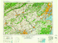
Newark, New Jersey, USGS topographic map dated 1960.
Includes geographic coordinates (latitude and longitude). This topographic map is suitable for hiking, camping, and exploring, or framing it as a wall map.
Printed on-demand using high resolution imagery, on heavy weight and acid free paper, or alternatively on a variety of synthetic materials.
Topos available on paper, Waterproof, Poly, or Tyvek. Usually shipping rolled, unless combined with other folded maps in one order.
- Product Number: USGS-5377644
- Free digital map download (high-resolution, GeoPDF): Newark, New Jersey (file size: 23 MB)
- Map Size: please refer to the dimensions of the GeoPDF map above
- Weight (paper map): ca. 55 grams
- Map Type: POD USGS Topographic Map
- Map Series: HTMC
- Map Verison: Historical
- Cell ID: 68933
- Scan ID: 255457
- Woodland Tint: Yes
- Aerial Photo Year: 1944
- Datum: Unstated
- Map Projection: Transverse Mercator
- Map published by United States Geological Survey
- Map Language: English
- Scanner Resolution: 600 dpi
- Map Cell Name: Newark
- Grid size: 1 X 2 Degree
- Date on map: 1960
- Map Scale: 1:250000
- Geographical region: New Jersey, United States
Neighboring Maps:
All neighboring USGS topo maps are available for sale online at a variety of scales.
Spatial coverage:
Topo map Newark, New Jersey, covers the geographical area associated the following places:
- Sellersville - Ramseysburg - Ronnie Park - Bath Beach - Cupola - Pennside - Far Hills - MacArthur Manor - Chatham Village of Towamencin - Cedarbrook Hill - Aluta - Providence Oaks - Moister Tract - Woodrow - West View - Lenhartsville - Westbury - Post Corner - Pompton - Rileyville - White Horse - Robinvale - Ashton Wooden Bridge - Harpers - Argus - Estate of Dublin - Wennersville - Juliustown - Caldwell - Short Hills - Trevose - John J Delaney Homes - East Orange - Nutley - Meetinghouse Village - Blair Mill Village East - Madison Ridge - Centerville - Graniteville - Smiths Corner - Wellington - Sayerwood South - Elmwood Park - Claytons Corner - Deans - Trent Manor - Oakwood Heights Station - Carlton Hill - Adams - Hanoverville - Hillside Terrace - Nelighsville - Whiteland Crest - Penndel - Quakertown - Morrell Corners - Greenview Estates - Graterford - Cheltenham - Knickerbocker - Quincy Hollow - Orchard Courts - Pawling Woods - Five Points - Leibeyville - Slatington - Modena Park - Sunwood Farm - Berwick Place - Walnuttown - Jackson - Ridgewood - Little Brook - Litzenberg - Lows Hollow - Cooperstown - Bath Addition - Indian Creek - Chimney Rock - Bristol Terrace Number Two - Arndts - Weatherly - Gwynedd Club - Gwynedd Valley - Ritter Estates - Brindletown - Collegeville Crossing - Hilpert - Laurelton Gardens - Alnwick - Yellow House - New Canton - Union - Asbury Park - Thomas Gardens - Belford - Sand Hills - Whitehouse Station - Centre Creek Estates - Edgewater Park
- Map Area ID: AREA4140-76-74
- Northwest corner Lat/Long code: USGSNW41-76
- Northeast corner Lat/Long code: USGSNE41-74
- Southwest corner Lat/Long code: USGSSW40-76
- Southeast corner Lat/Long code: USGSSE40-74
- Northern map edge Latitude: 41
- Southern map edge Latitude: 40
- Western map edge Longitude: -76
- Eastern map edge Longitude: -74


