
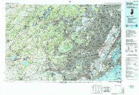
~ Newark NJ topo map, 1:100000 scale, 30 X 60 Minute, Historical, 1986, updated 1987
Newark, New Jersey, USGS topographic map dated 1986.
Includes geographic coordinates (latitude and longitude). This topographic map is suitable for hiking, camping, and exploring, or framing it as a wall map.
Printed on-demand using high resolution imagery, on heavy weight and acid free paper, or alternatively on a variety of synthetic materials.
Topos available on paper, Waterproof, Poly, or Tyvek. Usually shipping rolled, unless combined with other folded maps in one order.
- Product Number: USGS-5377612
- Free digital map download (high-resolution, GeoPDF): Newark, New Jersey (file size: 43 MB)
- Map Size: please refer to the dimensions of the GeoPDF map above
- Weight (paper map): ca. 55 grams
- Map Type: POD USGS Topographic Map
- Map Series: HTMC
- Map Verison: Historical
- Cell ID: 68049
- Scan ID: 255430
- Imprint Year: 1987
- Woodland Tint: Yes
- Aerial Photo Year: 1980
- Edit Year: 1986
- Datum: NAD27
- Map Projection: Universal Transverse Mercator
- Map published by United States Geological Survey
- Map Language: English
- Scanner Resolution: 600 dpi
- Map Cell Name: Newark
- Grid size: 30 X 60 Minute
- Date on map: 1986
- Map Scale: 1:100000
- Geographical region: New Jersey, United States
Neighboring Maps:
All neighboring USGS topo maps are available for sale online at a variety of scales.
Spatial coverage:
Topo map Newark, New Jersey, covers the geographical area associated the following places:
- Charleston - Pequannock - Lower Valley - Westville - Rahway - Parsippany - Pill Hill - Prospect Point - Pleasant Run - Mount Freedom - Penwell - Beach Glen - Preakness - Graniteville - Cherryville - Frankfort - Peapack - Berkeley Heights - Flagtown - Holcomb Mills - Concord - Garfield - Wayne - Edwin Markham Gardens - Littleton - Maplewood - Sand Hills - Dunellen - Allens Corner - Edison - Paulina - Shore Hills - Verona - Lake Parsippany - Afton - Little Brook - Loantaka Estates - Port Reading - Washington Valley - Lansdowne - Scotch Plains - Annandale - Grasmere - Quakertown - Crane Square - Rockaway Valley - Tranquility - North Branch - Landing - Greater Cross Roads - Ridgefield - Lebanon - East Orange - Bonaparte Landing - Rosedale Village - Martinsville - Newstead - Stephensburg - Royce Valley - Murray Hill - Hopelawn - Roseland - Staten Island - Crestmoore - Byram Cove - North Stelton - Clinton - Woods Tavern - White Meadow Lake - Marion - Kalarama - Springfield - Nixon - Arlington - Bay Terrace - Mount Hope - Madison Hill - Vliettown - Jacksonburg - Allwood - Grymes Hill - Bound Brook Junction - Crestview - South Bound Brook - Bath Beach - Free Acres - Bedminster - Woodfern - Meadow Village - Cushetunk - Mount Salem - Hilltown - River Edge - Madisonville - North Caldwell - Scrappy Corner - Bloomfield - Cherry Hill - Hutton Park - Beaufort
- Map Area ID: AREA4140.5-75-74
- Northwest corner Lat/Long code: USGSNW41-75
- Northeast corner Lat/Long code: USGSNE41-74
- Southwest corner Lat/Long code: USGSSW40.5-75
- Southeast corner Lat/Long code: USGSSE40.5-74
- Northern map edge Latitude: 41
- Southern map edge Latitude: 40.5
- Western map edge Longitude: -75
- Eastern map edge Longitude: -74


