
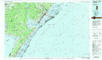
~ Atlantic City NJ topo map, 1:100000 scale, 30 X 60 Minute, Historical, 1984, updated 1985
Atlantic City, New Jersey, USGS topographic map dated 1984.
Includes geographic coordinates (latitude and longitude). This topographic map is suitable for hiking, camping, and exploring, or framing it as a wall map.
Printed on-demand using high resolution imagery, on heavy weight and acid free paper, or alternatively on a variety of synthetic materials.
Topos available on paper, Waterproof, Poly, or Tyvek. Usually shipping rolled, unless combined with other folded maps in one order.
- Product Number: USGS-5377602
- Free digital map download (high-resolution, GeoPDF): Atlantic City, New Jersey (file size: 31 MB)
- Map Size: please refer to the dimensions of the GeoPDF map above
- Weight (paper map): ca. 55 grams
- Map Type: POD USGS Topographic Map
- Map Series: HTMC
- Map Verison: Historical
- Cell ID: 67078
- Scan ID: 255423
- Imprint Year: 1985
- Woodland Tint: Yes
- Aerial Photo Year: 1977
- Edit Year: 1984
- Datum: NAD27
- Map Projection: Universal Transverse Mercator
- Map published by United States Geological Survey
- Map Language: English
- Scanner Resolution: 600 dpi
- Map Cell Name: Atlantic City
- Grid size: 30 X 60 Minute
- Date on map: 1984
- Map Scale: 1:100000
- Geographical region: New Jersey, United States
Neighboring Maps:
All neighboring USGS topo maps are available for sale online at a variety of scales.
Spatial coverage:
Topo map Atlantic City, New Jersey, covers the geographical area associated the following places:
- Jeffers Landing - Wildwood Junction - West Wildwood - Mount Pleasant - Venice Park - Menantico - Grassy Sound - Dennisville - Strathmere - Ventnor Heights - Kimbles Beach - Mays Landing - Clarkstown - Doughty - Highs Beach - Clover Leaf Lakes - Wilsons Landing - Cedar Springs - Burleigh - Ocean City - Whitesboro - Del Haven - Hunters Mill - Swain - Shellbed Landing - Kimseytown - Thelma - Leesburg - Estell Manor - Marshallville - Oceanville - Norburys Landing - Pierces - Gibson Landing - Fishing Creek - West Atlantic City - Marlyn Manor - New Italy - South Dennis - Hoffmans Mill - Delmont - Scull Landing - Warners Mill - Conovertown - South Seaville - Dias Creek - North Highlands Beach - Corbin City - Laureldale - East Vineland - Greenfield - Jones Mill - Pinehurst - Linwood - Eldora - Woodbine Junction - Marmora - Mount Pleasant - North Dennis - Bricksboro - Longport - Townsends Inlet - Smithville - Chelsea Heights - Absecon Highlands - Ocean Heights - Goshen Crossing - Clermont - McKee City - Seaville - Pomona - Dorothy - Richland - Ormond - Nummytown - Steelmantown - Gigantic City - English Creek - Leamings Mill - Petersburg - Erma Park - Mayville - Leeds Point - Bargaintown - Absecon - Estellville - Villas - North Wildwood - Five Points - Scotch Bonnet - Anglesea - Belleplain - Harding Lakes - Milmay - Cape May Court House - Stone Harbor Manor - Rio Grande - Port Elizabeth - Beesleys Point - Wildwood Highlands Beach
- Map Area ID: AREA39.539-75-74
- Northwest corner Lat/Long code: USGSNW39.5-75
- Northeast corner Lat/Long code: USGSNE39.5-74
- Southwest corner Lat/Long code: USGSSW39-75
- Southeast corner Lat/Long code: USGSSE39-74
- Northern map edge Latitude: 39.5
- Southern map edge Latitude: 39
- Western map edge Longitude: -75
- Eastern map edge Longitude: -74


