
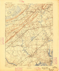
~ Plainfield NJ topo map, 1:62500 scale, 15 X 15 Minute, Historical, 1893, updated 1898
Plainfield, New Jersey, USGS topographic map dated 1893.
Includes geographic coordinates (latitude and longitude). This topographic map is suitable for hiking, camping, and exploring, or framing it as a wall map.
Printed on-demand using high resolution imagery, on heavy weight and acid free paper, or alternatively on a variety of synthetic materials.
Topos available on paper, Waterproof, Poly, or Tyvek. Usually shipping rolled, unless combined with other folded maps in one order.
- Product Number: USGS-5377462
- Free digital map download (high-resolution, GeoPDF): Plainfield, New Jersey (file size: 8 MB)
- Map Size: please refer to the dimensions of the GeoPDF map above
- Weight (paper map): ca. 55 grams
- Map Type: POD USGS Topographic Map
- Map Series: HTMC
- Map Verison: Historical
- Cell ID: 61052
- Scan ID: 255323
- Imprint Year: 1898
- Survey Year: 1887
- Datum: Unstated
- Map Projection: Unstated
- Map published by United States Geological Survey
- Map Language: English
- Scanner Resolution: 600 dpi
- Map Cell Name: Plainfield
- Grid size: 15 X 15 Minute
- Date on map: 1893
- Map Scale: 1:62500
- Geographical region: New Jersey, United States
Neighboring Maps:
All neighboring USGS topo maps are available for sale online at a variety of scales.
Spatial coverage:
Topo map Plainfield, New Jersey, covers the geographical area associated the following places:
- Tremont Park - William Dunlap Homes - Bonhamtown - Roselle Park - Port Reading - Union Village - North Stelton - Stelton - Menlo Park Terrace - Hazelton - Smalleytown - Floral Hill - Jefferson Park - Madison Hill - Cranford Junction - Woodbridge Oaks - New Providence - Newark Heights - Fords - Haven Homes - Perth Amboy - Baltusrol - Park Village - Stony Hill - Clark - Washington Park - Green Village - Murray Hill - Oakwood Park - Aldene - White Oak Ridge - Barber - Phoenix - Edgar - Short Hills - Maurer - New Vernon - Wyoming - Woodbridge - John J Delaney Homes - Colonia - South Orange - Westfield - Pleasant Plains - Metuchen - Boynton Beach - Glenfield - Woodland Park - Mountainside - Nixon - Glendinning Homes - Pleasantville - Overlook - Millburn - Free Acres - Stirling - Riverview Manor - Summit - Winfield - Dunellen - Pumptown - Vauxhall - Homestead Park - Unionburg - South Plainfield - Randolphville - Cranford - Long Hill - Staten Island Junction - Avon Park - Valentine - Brantwood - Edison - Springfield - Raritan Manor - Oak Tree - Lincoln Park - Perth Amboy Junction - Keasbey - Lahiere - North Edison - Lindenau - Robinvale - Newtown - Middlesex - New Market - Warrenville - Shore View - Fanwood - Meyersville - Sand Hills - Watchung - Maplewood - Roselle - Netherwood - Plainfield - Potters - Scotch Plains - Rahway - Garwood
- Map Area ID: AREA40.7540.5-74.5-74.25
- Northwest corner Lat/Long code: USGSNW40.75-74.5
- Northeast corner Lat/Long code: USGSNE40.75-74.25
- Southwest corner Lat/Long code: USGSSW40.5-74.5
- Southeast corner Lat/Long code: USGSSE40.5-74.25
- Northern map edge Latitude: 40.75
- Southern map edge Latitude: 40.5
- Western map edge Longitude: -74.5
- Eastern map edge Longitude: -74.25


