
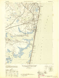
~ Point Pleasant NJ topo map, 1:24000 scale, 7.5 X 7.5 Minute, Historical, 1947
Point Pleasant, New Jersey, USGS topographic map dated 1947.
Includes geographic coordinates (latitude and longitude). This topographic map is suitable for hiking, camping, and exploring, or framing it as a wall map.
Printed on-demand using high resolution imagery, on heavy weight and acid free paper, or alternatively on a variety of synthetic materials.
Topos available on paper, Waterproof, Poly, or Tyvek. Usually shipping rolled, unless combined with other folded maps in one order.
- Product Number: USGS-5376518
- Free digital map download (high-resolution, GeoPDF): Point Pleasant, New Jersey (file size: 10 MB)
- Map Size: please refer to the dimensions of the GeoPDF map above
- Weight (paper map): ca. 55 grams
- Map Type: POD USGS Topographic Map
- Map Series: HTMC
- Map Verison: Historical
- Cell ID: 35808
- Scan ID: 254761
- Aerial Photo Year: 1940
- Datum: NAD27
- Map Projection: Transverse Mercator
- Map published by United States Army
- Map Language: English
- Scanner Resolution: 600 dpi
- Map Cell Name: Point Pleasant
- Grid size: 7.5 X 7.5 Minute
- Date on map: 1947
- Map Scale: 1:24000
- Geographical region: New Jersey, United States
Neighboring Maps:
All neighboring USGS topo maps are available for sale online at a variety of scales.
Spatial coverage:
Topo map Point Pleasant, New Jersey, covers the geographical area associated the following places:
- Brielle - Riviera Beach - Manasquan Park - Bay Head - Normandy Beach - Breton Woods - Metedeconk - Mantoloking - Pine Terrace - Sterling Woods - West Point Pleasant - South Mantoloking Beach - Winding River Village - Cherry Quay - Green Island - Arrowhead Village - Mantoloking Estates - Point Pleasant - Bay Head Junction - Point Pleasant Beach - Silver Bay - Mantoloking Shores - Adamston - Baywood - Shore Acres - Clarks Landing - Herbertsville - West Mantoloking - Camp Osborne - Osbornsville - Mandalay - West Osbornsville
- Map Area ID: AREA40.12540-74.125-74
- Northwest corner Lat/Long code: USGSNW40.125-74.125
- Northeast corner Lat/Long code: USGSNE40.125-74
- Southwest corner Lat/Long code: USGSSW40-74.125
- Southeast corner Lat/Long code: USGSSE40-74
- Northern map edge Latitude: 40.125
- Southern map edge Latitude: 40
- Western map edge Longitude: -74.125
- Eastern map edge Longitude: -74


