
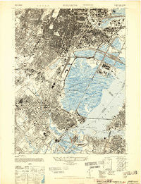
~ Elizabeth NJ topo map, 1:24000 scale, 7.5 X 7.5 Minute, Historical, 1947
Elizabeth, New Jersey, USGS topographic map dated 1947.
Includes geographic coordinates (latitude and longitude). This topographic map is suitable for hiking, camping, and exploring, or framing it as a wall map.
Printed on-demand using high resolution imagery, on heavy weight and acid free paper, or alternatively on a variety of synthetic materials.
Topos available on paper, Waterproof, Poly, or Tyvek. Usually shipping rolled, unless combined with other folded maps in one order.
- Product Number: USGS-5375818
- Free digital map download (high-resolution, GeoPDF): Elizabeth, New Jersey (file size: 17 MB)
- Map Size: please refer to the dimensions of the GeoPDF map above
- Weight (paper map): ca. 55 grams
- Map Type: POD USGS Topographic Map
- Map Series: HTMC
- Map Verison: Historical
- Cell ID: 13948
- Scan ID: 254344
- Aerial Photo Year: 1941
- Datum: NAD27
- Map Projection: Transverse Mercator
- Map published by United States Army
- Map Language: English
- Scanner Resolution: 600 dpi
- Map Cell Name: Elizabeth
- Grid size: 7.5 X 7.5 Minute
- Date on map: 1947
- Map Scale: 1:24000
- Geographical region: New Jersey, United States
Neighboring Maps:
All neighboring USGS topo maps are available for sale online at a variety of scales.
Spatial coverage:
Topo map Elizabeth, New Jersey, covers the geographical area associated the following places:
- Old Place - Newark - Union Square - Irvington - East Newark - Bayway - Port Ivory - Hillside - Port Richmond - Christopher Columbus Homes - Elizabeth - Elmora - Crane Square - Liberty Square - Mariners Harbor - Pioneer Homes - Harrison - Arlington - Oak Island Junction - Bergen Point - Elm Park - Elizabethport - Mravlag Manor - Gulfport
- Map Area ID: AREA40.7540.625-74.25-74.125
- Northwest corner Lat/Long code: USGSNW40.75-74.25
- Northeast corner Lat/Long code: USGSNE40.75-74.125
- Southwest corner Lat/Long code: USGSSW40.625-74.25
- Southeast corner Lat/Long code: USGSSE40.625-74.125
- Northern map edge Latitude: 40.75
- Southern map edge Latitude: 40.625
- Western map edge Longitude: -74.25
- Eastern map edge Longitude: -74.125


