
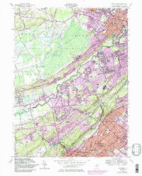
~ Chatham NJ topo map, 1:24000 scale, 7.5 X 7.5 Minute, Historical, 1955, updated 1986
Chatham, New Jersey, USGS topographic map dated 1955.
Includes geographic coordinates (latitude and longitude). This topographic map is suitable for hiking, camping, and exploring, or framing it as a wall map.
Printed on-demand using high resolution imagery, on heavy weight and acid free paper, or alternatively on a variety of synthetic materials.
Topos available on paper, Waterproof, Poly, or Tyvek. Usually shipping rolled, unless combined with other folded maps in one order.
- Product Number: USGS-5375688
- Free digital map download (high-resolution, GeoPDF): Chatham, New Jersey (file size: 18 MB)
- Map Size: please refer to the dimensions of the GeoPDF map above
- Weight (paper map): ca. 55 grams
- Map Type: POD USGS Topographic Map
- Map Series: HTMC
- Map Verison: Historical
- Cell ID: 8273
- Scan ID: 254273
- Imprint Year: 1986
- Woodland Tint: Yes
- Visual Version Number: 2
- Photo Revision Year: 1981
- Aerial Photo Year: 1976
- Edit Year: 1981
- Field Check Year: 1943
- Datum: NAD27
- Map Projection: Polyconic
- Map published by United States Army Corps of Engineers
- Map Language: English
- Scanner Resolution: 600 dpi
- Map Cell Name: Chatham
- Grid size: 7.5 X 7.5 Minute
- Date on map: 1955
- Map Scale: 1:24000
- Geographical region: New Jersey, United States
Neighboring Maps:
All neighboring USGS topo maps are available for sale online at a variety of scales.
Spatial coverage:
Topo map Chatham, New Jersey, covers the geographical area associated the following places:
- Gillette - Washingtonville - Glenfield - Plainfield - Crestview - Murray Hill - Chatham - Free Acres - Woodland Park - Watchung - Homestead Park - New Vernon - Union Village - Scotch Plains - Green Village - Hickory Tree - Stirling - Meyersville - Oakwood Park - Berkeley Heights - Long Hill - North Plainfield - Benders Corner - Netherwood - Smalleytown - Pleasantville - Stony Hill - Pleasant Plains - Fanwood - New Providence - Floral Hill
- Map Area ID: AREA40.7540.625-74.5-74.375
- Northwest corner Lat/Long code: USGSNW40.75-74.5
- Northeast corner Lat/Long code: USGSNE40.75-74.375
- Southwest corner Lat/Long code: USGSSW40.625-74.5
- Southeast corner Lat/Long code: USGSSE40.625-74.375
- Northern map edge Latitude: 40.75
- Southern map edge Latitude: 40.625
- Western map edge Longitude: -74.5
- Eastern map edge Longitude: -74.375


