
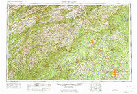
~ Winston Salem NC topo map, 1:250000 scale, 1 X 2 Degree, Historical, 1953, updated 1974
Winston Salem, North Carolina, USGS topographic map dated 1953.
Includes geographic coordinates (latitude and longitude). This topographic map is suitable for hiking, camping, and exploring, or framing it as a wall map.
Printed on-demand using high resolution imagery, on heavy weight and acid free paper, or alternatively on a variety of synthetic materials.
Topos available on paper, Waterproof, Poly, or Tyvek. Usually shipping rolled, unless combined with other folded maps in one order.
- Product Number: USGS-5375056
- Free digital map download (high-resolution, GeoPDF): Winston Salem, North Carolina (file size: 28 MB)
- Map Size: please refer to the dimensions of the GeoPDF map above
- Weight (paper map): ca. 55 grams
- Map Type: POD USGS Topographic Map
- Map Series: HTMC
- Map Verison: Historical
- Cell ID: 74975
- Scan ID: 164062
- Imprint Year: 1974
- Woodland Tint: Yes
- Visual Version Number: 2
- Photo Revision Year: 1962
- Field Check Year: 1953
- Datum: Unstated
- Map Projection: Transverse Mercator
- Map published by United States Geological Survey
- Map Language: English
- Scanner Resolution: 600 dpi
- Map Cell Name: Winston-Salem
- Grid size: 1 X 2 Degree
- Date on map: 1953
- Map Scale: 1:250000
- Geographical region: North Carolina, United States
Neighboring Maps:
All neighboring USGS topo maps are available for sale online at a variety of scales.
Spatial coverage:
Topo map Winston Salem, North Carolina, covers the geographical area associated the following places:
- Reese - Mill Creek - Locust Hill - Boone - Stamey Town - Elk Garden - Laurel Branch - Pike City - Moxley - Boom Furnace - Call - Delhart - Day Acres - Holy Hill - Tumbling Creek - Farthing (historical) - Stonewood Acres - Forest Hills - West Highlands - Jacob (historical) - Delmar - New Hope - Valley View - Washington Springs - Dockery - Farmington - Stratford - Ennice - Forest Hills Estates - Long Hill - Darby - Cranberry - Stringtown - Fries Junction - Haycock - Mount Gilead - Vilas - Transou - Hilltown - Enon - Chalk Level (historical) - Simmerman - Kindrick - Zephyr - Brookside (historical) - Fosters Falls - Newlife (historical) - Reavistown - West Bassett - Carters Mill - Austin - Noble Furnace - Idlewild - Stump Knob (historical) - Beech Creek - Peden - Cinnamon Ridge - Bonanza Hills - Apple Ridge - Mulberry - Hariston (historical) - West Galax - Galena - Clinchburg - Mount Pleasant - Pleasant Hill - Lawsonville - Eaglewood - Abington - Westwood Hills - Echo Park - Robinhood Forest - Tuggles Gap - Sharps - Azen - Coleman Store - Union Cross - Mount Olive - Smithtown - Baywood - Gladesboro - Buena Vista - Cosfort (historical) - Laurel Bloomery - Round Peak - Fig - Harley - Courtney - Poplar Springs - Vesta - Walton Furnace - Fort Chiswell - Clemmons - Trade - Stanleyville - Greystone Forest - Kegleys - Blackwell - Applegate - Park Terrace
- Map Area ID: AREA3736-82-80
- Northwest corner Lat/Long code: USGSNW37-82
- Northeast corner Lat/Long code: USGSNE37-80
- Southwest corner Lat/Long code: USGSSW36-82
- Southeast corner Lat/Long code: USGSSE36-80
- Northern map edge Latitude: 37
- Southern map edge Latitude: 36
- Western map edge Longitude: -82
- Eastern map edge Longitude: -80


