
~ Winston Salem NC topo map, 1:250000 scale, 1 X 2 Degree, Historical, 1955
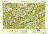
Winston Salem, North Carolina, USGS topographic map dated 1955.
Includes geographic coordinates (latitude and longitude). This topographic map is suitable for hiking, camping, and exploring, or framing it as a wall map.
Printed on-demand using high resolution imagery, on heavy weight and acid free paper, or alternatively on a variety of synthetic materials.
Topos available on paper, Waterproof, Poly, or Tyvek. Usually shipping rolled, unless combined with other folded maps in one order.
- Product Number: USGS-5375054
- Free digital map download (high-resolution, GeoPDF): Winston Salem, North Carolina (file size: 25 MB)
- Map Size: please refer to the dimensions of the GeoPDF map above
- Weight (paper map): ca. 55 grams
- Map Type: POD USGS Topographic Map
- Map Series: HTMC
- Map Verison: Historical
- Cell ID: 74975
- Scan ID: 164061
- Woodland Tint: Yes
- Field Check Year: 1953
- Datum: Unstated
- Map Projection: Transverse Mercator
- Map published by United States Army Corps of Engineers
- Map published by United States Army
- Map Language: English
- Scanner Resolution: 600 dpi
- Map Cell Name: Winston-Salem
- Grid size: 1 X 2 Degree
- Date on map: 1955
- Map Scale: 1:250000
- Geographical region: North Carolina, United States
Neighboring Maps:
All neighboring USGS topo maps are available for sale online at a variety of scales.
Spatial coverage:
Topo map Winston Salem, North Carolina, covers the geographical area associated the following places:
- Stamey Town - Fleetwood - Elkville - Helton - Davenport (historical) - Pine Knolls - Harr - Salem - Bethania - Fries Junction - Cliffwood - Smart - Shoals - Elk Mills - Brier Creek (historical) - Old Glade Spring - Amostown - Walton Furnace - Bethania Station - Washington Springs - Marion - Moores Springs - Dougherty Heights - Brim (historical) - Philpott - Branon - Sweetwater - Norwood Hollow - Fairview - Allisonia - Mountain Manor - Masada - Rackettown - Buffalo - Union Hill - Peach Bottom - Mulberry - Grahams Forge - Fox Hall - Columbia Heights - Cricket Park - Belews Creek - Prilliman - Pottertown - Mount Zion - Dillons Fork - Hay Meadow (historical) - Lowgap - Weatherspon (historical) - Harmon - Cycle - Purlear - Chestnut Trails - Dalton - Reese - Fuller - Piney Creek - Siloam - Nettle Ridge - Kelsey - McMullin - Stokesburg - Glade Spring - Hebron - Fletcher (historical) - Matney - Chatham Hill - Georgetown - Ogburn Station - Creek View - Willen Gap - Quail Hollow - Elamsville - Cherokee Woods - Dodson - Mount Pleasant - Raketown - Jett - Poff - Reed Junction - Darby - Dilhast - Oldtown - Bamboo - Fox - Heath - Green Spring - Atwood - Zion (historical) - Smethport - Pine Fork - Chestnut Hill - Shortsville - Vox - Hughes - Westfield - Brown Mountain - Wellington Way - Thurmond - Higgins Crossroads
- Map Area ID: AREA3736-82-80
- Northwest corner Lat/Long code: USGSNW37-82
- Northeast corner Lat/Long code: USGSNE37-80
- Southwest corner Lat/Long code: USGSSW36-82
- Southeast corner Lat/Long code: USGSSE36-80
- Northern map edge Latitude: 37
- Southern map edge Latitude: 36
- Western map edge Longitude: -82
- Eastern map edge Longitude: -80


