
~ Rocky Mount NC topo map, 1:250000 scale, 1 X 2 Degree, Historical, 1953, updated 1980
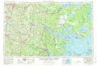
Rocky Mount, North Carolina, USGS topographic map dated 1953.
Includes geographic coordinates (latitude and longitude). This topographic map is suitable for hiking, camping, and exploring, or framing it as a wall map.
Printed on-demand using high resolution imagery, on heavy weight and acid free paper, or alternatively on a variety of synthetic materials.
Topos available on paper, Waterproof, Poly, or Tyvek. Usually shipping rolled, unless combined with other folded maps in one order.
- Product Number: USGS-5375046
- Free digital map download (high-resolution, GeoPDF): Rocky Mount, North Carolina (file size: 22 MB)
- Map Size: please refer to the dimensions of the GeoPDF map above
- Weight (paper map): ca. 55 grams
- Map Type: POD USGS Topographic Map
- Map Series: HTMC
- Map Verison: Historical
- Cell ID: 68991
- Scan ID: 164767
- Imprint Year: 1980
- Woodland Tint: Yes
- Aerial Photo Year: 1976
- Edit Year: 1980
- Field Check Year: 1953
- Datum: NAD27
- Map Projection: Transverse Mercator
- Map published by United States Geological Survey
- Map Language: English
- Scanner Resolution: 600 dpi
- Map Cell Name: Rocky Mount
- Grid size: 1 X 2 Degree
- Date on map: 1953
- Map Scale: 1:250000
- Geographical region: North Carolina, United States
Neighboring Maps:
All neighboring USGS topo maps are available for sale online at a variety of scales.
Spatial coverage:
Topo map Rocky Mount, North Carolina, covers the geographical area associated the following places:
- Paige - Oakdale - Woodcrest Park - Castle Oaks - Foxtail Mobile Home Park - Bearcreek - Club Pines - Jones Corner - Church Crossroads - Sedgefield - Black Jack - New Holland - Wiggins Mill - Shadetown - Sandy Creek - Jasper - Bullucks Crossroads - Greyleigh - Olivers - Belhaven - Briarwood Terrace - Frog Level - Eastover - Strabane - Wilson - Lenoir Pines - Resaca - James City - Pinewood Estates - Sleepy Fox Village Mobile Home Park - River Neck - Colonial Heights - Random Woods - Stafford Forest - Hackney - Wintergreen - Makleyville - Sun Valley - Moores Beach - Haywood Farms - Trent Shores - Westmoreland - Eastwood - Forrest Road Homes - Blands Crossroads - Lilliput Landing - George Washington Carver - Shady Grove - Forest Oaks - Pineygrove - Bell Fork - Sherwood Forest - Deans Heights - South Rocky Mount - Staton - Dixie - Musgrave Crossroads - Jason - Rosebud - Golden Place - Fox Chase Village Mobile Home Park - Sans Souci - Maury - Woodgreen - Slatestone - Woodside Mobile Home Park - West Tarboro - Wilco Manor Mobile Home Park - Dardens - Mewborns Crossroads - Logsboro - Nobles Mill - McNair Crossing - Pineview Acres - Williams - Camp Leach - Caseys Trailer Lodge - Parkstown - Pantego - Olympia - Southside Park - Pike Road - Grantsboro - Happersville (historical) - Shines Crossroads - Biltmore - Woodland Acres - Waterford - Saint Johns - Evans Park - New Bern - Tuscarora - Woodington - Millers Store - Scarborough - Sidney Crossroads - Oyster Creek Landing - Columbia - Country Club Park - Arbor Hills
- Map Area ID: AREA3635-78-76
- Northwest corner Lat/Long code: USGSNW36-78
- Northeast corner Lat/Long code: USGSNE36-76
- Southwest corner Lat/Long code: USGSSW35-78
- Southeast corner Lat/Long code: USGSSE35-76
- Northern map edge Latitude: 36
- Southern map edge Latitude: 35
- Western map edge Longitude: -78
- Eastern map edge Longitude: -76


