
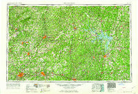
~ Greensboro NC topo map, 1:250000 scale, 1 X 2 Degree, Historical, 1962
Greensboro, North Carolina, USGS topographic map dated 1962.
Includes geographic coordinates (latitude and longitude). This topographic map is suitable for hiking, camping, and exploring, or framing it as a wall map.
Printed on-demand using high resolution imagery, on heavy weight and acid free paper, or alternatively on a variety of synthetic materials.
Topos available on paper, Waterproof, Poly, or Tyvek. Usually shipping rolled, unless combined with other folded maps in one order.
- Product Number: USGS-5375018
- Free digital map download (high-resolution, GeoPDF): Greensboro, North Carolina (file size: 23 MB)
- Map Size: please refer to the dimensions of the GeoPDF map above
- Weight (paper map): ca. 55 grams
- Map Type: POD USGS Topographic Map
- Map Series: HTMC
- Map Verison: Historical
- Cell ID: 68807
- Scan ID: 162530
- Woodland Tint: Yes
- Edit Year: 1962
- Field Check Year: 1953
- Datum: Unstated
- Map Projection: Transverse Mercator
- Map published by United States Geological Survey
- Map Language: English
- Scanner Resolution: 600 dpi
- Map Cell Name: Greensboro
- Grid size: 1 X 2 Degree
- Date on map: 1962
- Map Scale: 1:250000
- Geographical region: North Carolina, United States
Neighboring Maps:
All neighboring USGS topo maps are available for sale online at a variety of scales.
Spatial coverage:
Topo map Greensboro, North Carolina, covers the geographical area associated the following places:
- Cooper Estates - Volens - Glennfarm Estates - Surry Hills - Huntsboro - Bethel - Riverbend - Dortch Store - Clover - Dexter - Fleming Corner - Newmans - Mays Crossroads - Castalia - Floytan Crossroads - Tungsten - Shiloh Acres - Huntington Place - Stagecoach Forest - Midway - Busy Bee Corner - Pinewood Forest - Troxlers Mill - Smith Acres - Pleasant Grove - Grissom - Pickwood Hills - Siddon - Greenfield - Shiloh - Dundas - Oregon Hill - Lindley Park - Ridgeway - Woodlawn - Topnot - Springfield - Graber Heights - Drakes Branch - Blanch - Hunter Hills - Mill Grove - Gorman - Leasburg - Elberon - Sandy Cross - Westside Village - Woodlawn Heights - Hermosa - Lake View - Major Court - Green Level - Ellisboro - Country Place - Jordan Oak - Ringgold - Five Forks - Penhook - Highland Hills - Efland - Barfoot - Gupton - Wilton - Kittrell - Cozart - Graham - Piedmont Heights - Vashti - Knotts Crossroads - Whiteoak (historical) - Blackridge - Glenwood - Merifield Acres - Green Pond - Glen Raven - Rehoboth - Gregory Corner - Pine Crest - West Fork - Allison - Perry Hills - Oak Hill - Rondo - Green Valley - Reed Creek Village - Williamsburg - Riceville - Lyons - Harmony - Leviva - Hitesburg - Bracy Station - Motleys Mill - Plantersville - Boxwood - Pickerel - Piedmont Heights - Park Spring - Greenfield - McCray
- Map Area ID: AREA3736-80-78
- Northwest corner Lat/Long code: USGSNW37-80
- Northeast corner Lat/Long code: USGSNE37-78
- Southwest corner Lat/Long code: USGSSW36-80
- Southeast corner Lat/Long code: USGSSE36-78
- Northern map edge Latitude: 37
- Southern map edge Latitude: 36
- Western map edge Longitude: -80
- Eastern map edge Longitude: -78


