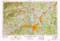
~ Charlotte NC topo map, 1:250000 scale, 1 X 2 Degree, Historical, 1953, updated 1975
Charlotte, North Carolina, USGS topographic map dated 1953.
Includes geographic coordinates (latitude and longitude). This topographic map is suitable for hiking, camping, and exploring, or framing it as a wall map.
Printed on-demand using high resolution imagery, on heavy weight and acid free paper, or alternatively on a variety of synthetic materials.
Topos available on paper, Waterproof, Poly, or Tyvek. Usually shipping rolled, unless combined with other folded maps in one order.
- Product Number: USGS-5375010
- Free digital map download (high-resolution, GeoPDF): Charlotte, North Carolina (file size: 25 MB)
- Map Size: please refer to the dimensions of the GeoPDF map above
- Weight (paper map): ca. 55 grams
- Map Type: POD USGS Topographic Map
- Map Series: HTMC
- Map Verison: Historical
- Cell ID: 68711
- Scan ID: 164185
- Imprint Year: 1975
- Woodland Tint: Yes
- Aerial Photo Year: 1972
- Edit Year: 1974
- Field Check Year: 1953
- Datum: Unstated
- Map Projection: Transverse Mercator
- Map published by United States Geological Survey
- Map Language: English
- Scanner Resolution: 600 dpi
- Map Cell Name: Charlotte
- Grid size: 1 X 2 Degree
- Date on map: 1953
- Map Scale: 1:250000
- Geographical region: North Carolina, United States
Neighboring Maps:
All neighboring USGS topo maps are available for sale online at a variety of scales.
Spatial coverage:
Topo map Charlotte, North Carolina, covers the geographical area associated the following places:
- Queens Grant - Cleveland Spring (historical) - Frohock Mill (historical) - Hidden Valley Estates - Town and Country - Midway - Tryon - Jubilee - Buffalo - Wyndemere Crossing - College Park - Steel Worth Park - Sawmills - Ramblewood - Jackson Creek - Cooks Crossing - Granite Quarry - Royal Park - Dallas - Ellington Heights - Salisbury - Barclay Downs - Petra Mills - Valdese - Biddleville - Patterson Springs - Friedburg - Dilworth - Brief - Chipley Park - North Barringer (historical) - White Pines - Holbrook - Holly Hills - Rolling Acres - Mineral Spring (historical) - Troutman - Millingport - Bentons Crossroads - Brookgreen - Hicks Crossroads - Yorkmont - Crouse - Mount Pisgah (historical) - Five Points - Hebron (historical) - Bethany - Helms Park - Carolina Forest - Hardaway (historical) - Ashley Heights - Huntingtowne Farms - Rocky River - Clear Creek (historical) - Rufus - Oak Hill - Kirkland (historical) - Earl - Sandy Mush - Dover - Bowling Green - Fairway Acres - Hollyoak Apartments - Island View Landing - Oakhurst - Finger - Franklin - Westport - Canterbury Heights - Orchard Knoll - Wildwoods - Camelot - Woodcrest - Brookwood Estates - Old Providence - Rosemont - Redland - Providence (historical) - Hickory Grove (historical) - Pleasant Hills - University Place - Northwood - Woodford Green - Kings Creek - Mountain View - Carmel Woods - Taragate Farms - Sedgefield Acres - Dixon - Carolina - Tate (historical) - West Lenoir - Bostian Heights - Grier Heights - Rehobeth - Sulphur Springs - Drowning Creek (historical) - Dudley Shoals - Ebenezers - Cold Springs
- Map Area ID: AREA3635-82-80
- Northwest corner Lat/Long code: USGSNW36-82
- Northeast corner Lat/Long code: USGSNE36-80
- Southwest corner Lat/Long code: USGSSW35-82
- Southeast corner Lat/Long code: USGSSE35-80
- Northern map edge Latitude: 36
- Southern map edge Latitude: 35
- Western map edge Longitude: -82
- Eastern map edge Longitude: -80

